Phantom Ranch Hike to Bottom of the Grand Canyon
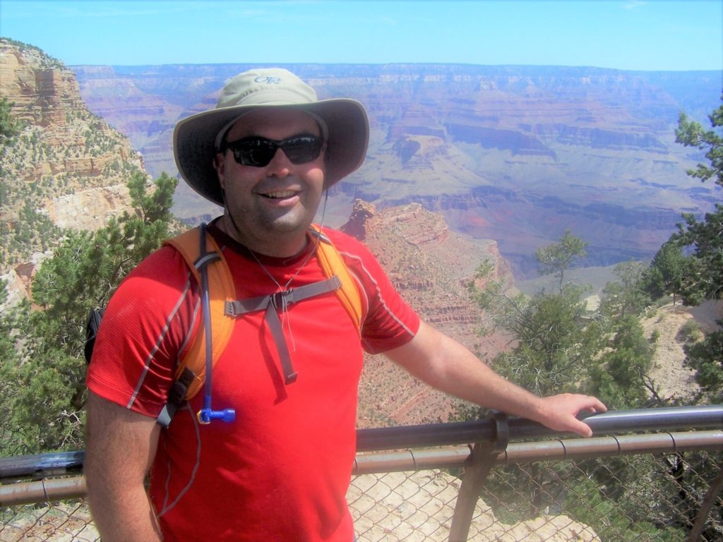
Have you dreamed about hiking to the bottom of the Grand Canyon? Me, too. But I had to put off my first Grand Canyon hiking trip an extra year because I didn’t realize how much advanced planning it took to spend a night in the canyon. Luckily, I lived in Arizona, so I eventually had several opportunities to hike from the rim to the river. But many travelers miss out on this bucket-list hike because they start their trip planning way too late for backcountry permits or overnight reservations. Here’s a trip planning guide for hiking down to the Colorado River and back on a loop hike from the South Rim to Phantom Ranch.
South Rim to Phantom Ranch
The most accessible route to the bottom of the Grand Canyon is from the South Rim to Phantom Ranch. The National Park Service does NOT recommend hiking from the rim to the Colorado River and back in one day. I’ve done it, but I agree that a day hike is a probably a bad idea unless you’re acclimated to the desert and have previous Grand Canyon hiking experience. It’s an extreme environment, and even experienced hikers underestimate how much Grand Canyon hiking differs from most other hiking experiences. Besides, if you haven’t hiked down into the Grand Canyon before, why would you want to get out as soon as possible? And why skip the chance to spend a memorable night at the bottom?
If it’s your first hike below the rim, the best choice is to hike from the rim to the river and back in two days, spending a night (or two) at Phantom Ranch.
Phantom Ranch: a backcountry Mecca
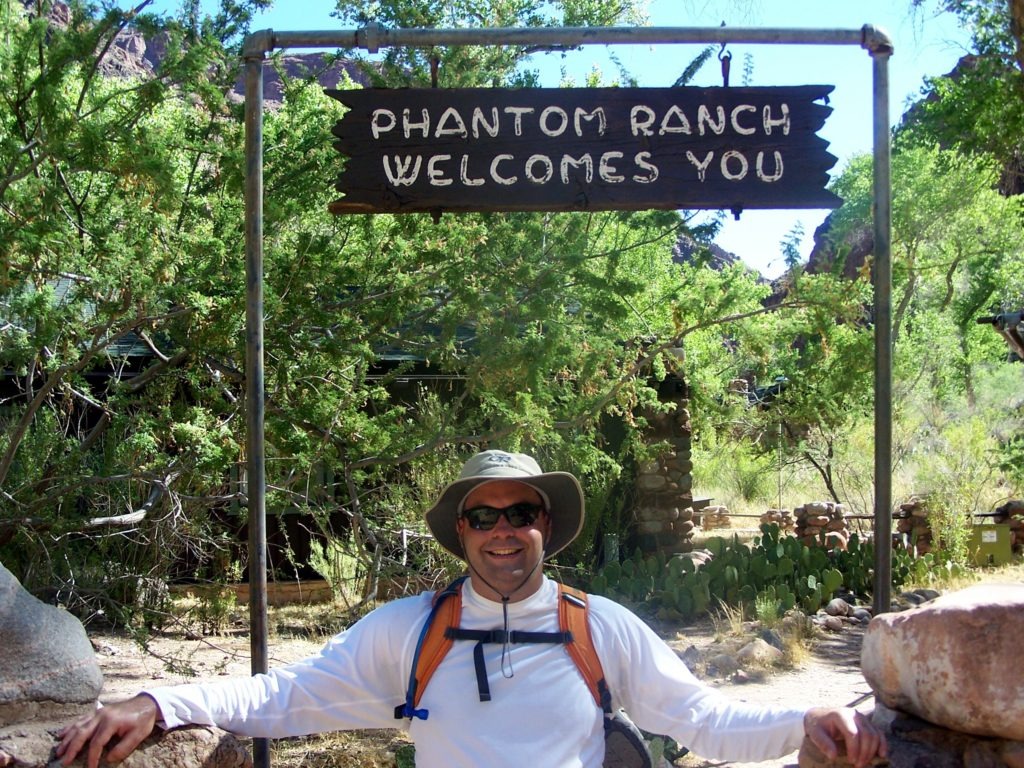
Phantom Ranch is a historic lodge nestled deep in the Grand Canyon. For a century now, it’s been an idyllic rest stop for river rafters, mule trains, backpackers, and day hikers who make it to the bottom of the canyon. The accommodations themselves are nothing special, really. Just a cluster of small cabins and bunk houses. But bunk beds are true luxuries down in the canyon. So are warm showers, cold beer, and ice cream. There’s steak, vegetarian chili, or hikers’ stew for those with dinner reservations. And–most importantly–the location is world-class.
Phantom Ranch is a Mecca for hikers. Avid hikers should try to get here at least once. But you’ve got to overcome two huge challenges to make the pilgrimage:
- The Hike. It’s a steep and strenuous hike down to the river–nearly a mile in elevation change–with an even harder hike back up to the rim.
- The Lottery. You must enter a lottery to score an overnight reservation or backcountry permit. For the best odds, you’ll need to start this process fifteen months (Phantom Ranch) or four months (backcountry campsite) ahead of time–see details below.
Let’s start with the hike.
best hike to the bottom of the Grand Canyon
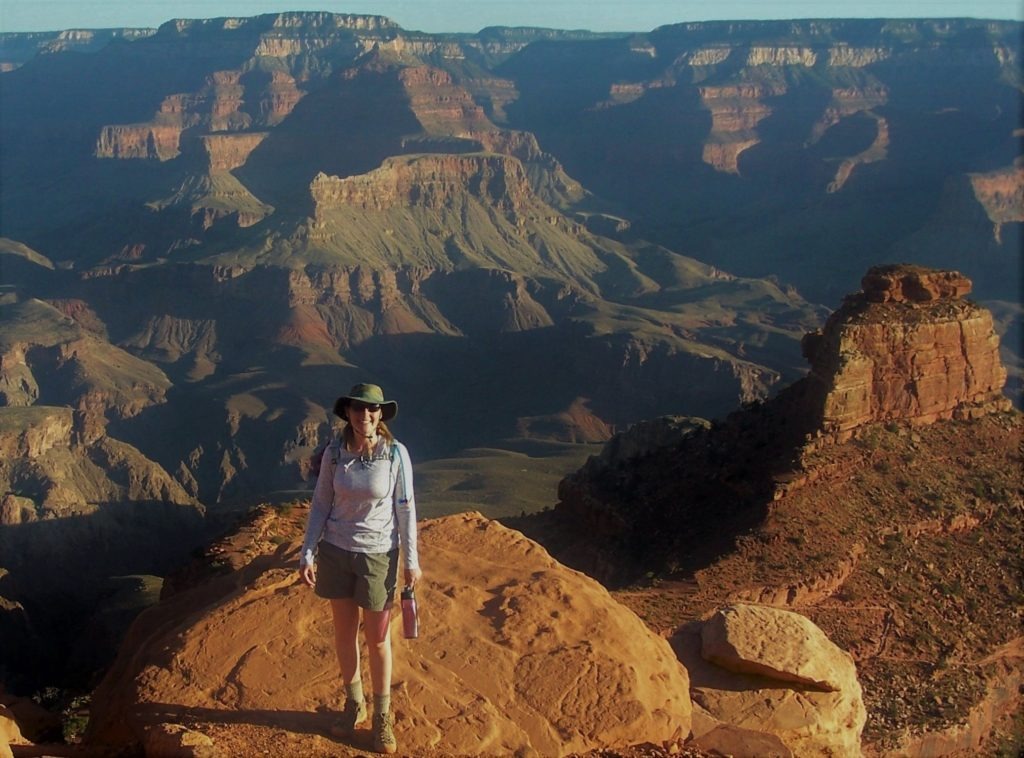
How do you get to the bottom of the Grand Canyon? Many hikers stick to the Bright Angel Trail for a convenient out-and-back hike from Grand Canyon Village. However, the best hike from the South Rim is a 17.4 mile loop using the South Kaibab and Bright Angel trails. The direction is important (especially in summer): It’s best to go down South Kaibab and back up Bright Angel. This loop not only avoids the repetition of an out-and-back hike. It also has the most expansive views going down, reduces your sun exposure, and maximizes your water access on the hard, uphill slog back to the South Rim.
South Kaibab Trail
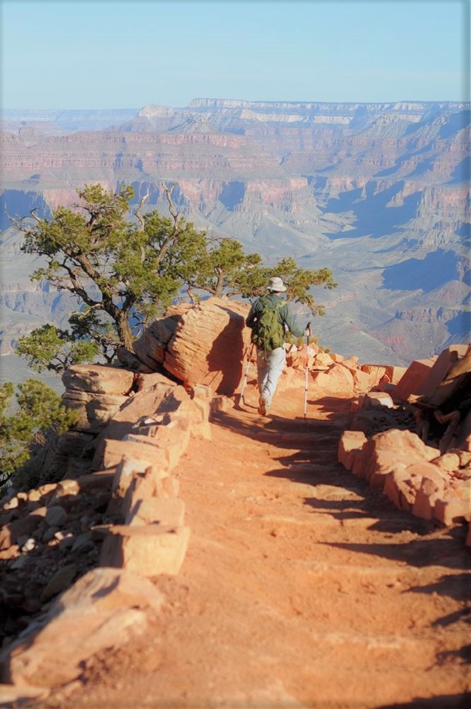
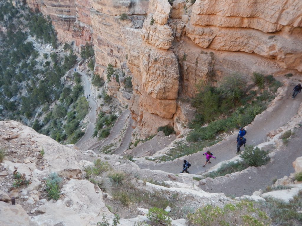
South Kaibab Trail is the most direct route to the bottom of the canyon. The trail begins few miles outside of Grand Canyon Village. To reach the trailhead, hop on the free Hikers’ Express Shuttle Bus (early morning) or orange route bus (daytime) to the South Kaibab Trail stop. There’s a staging area with toilets and a water station (seasonal). There’s no water on South Kaibab Trail. So top off your water, and psyche yourself up for a world-class hike.
Once you step on to South Kaibab Trail, you don’t have to wait long for the first set of switchbacks. There’s no fore play–once you leave the rim, you get right down in it. This trail’s in a hurry to reach the Colorado River.
South Kaibab’s Panoramic Views
Bright Angel Trail may be the park’s premier trail. But South Kaibab Trail has more open and panoramic views of the Grand Canyon.
You should probably keep your camera handy. Once you’ve cleared the first set of switchbacks, the trail turns toward an open ridge and descends a series of overlooks that are made for selfies, Insta, and Kodak moments.
About a mile into the hike, for example, you’ll want to linger at Ooh Aah Point to savor the expansive views of the inner canyon.
You’ll drop another 500 feet over the next half mile as the trail descends to Cedar Ridge–another one of the iconic overlooks in the Grand Canyon.
Skeleton Point is your next major landmark. From here, you’ll drop 1200 feet in the next mile or so through a series of steep switchbacks.

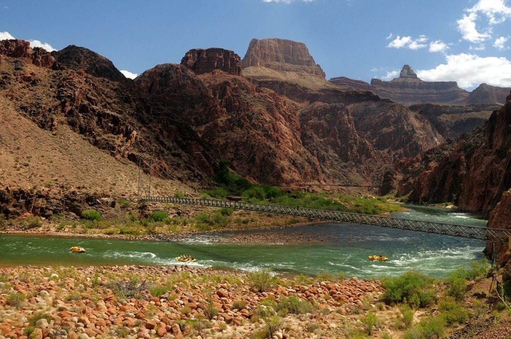
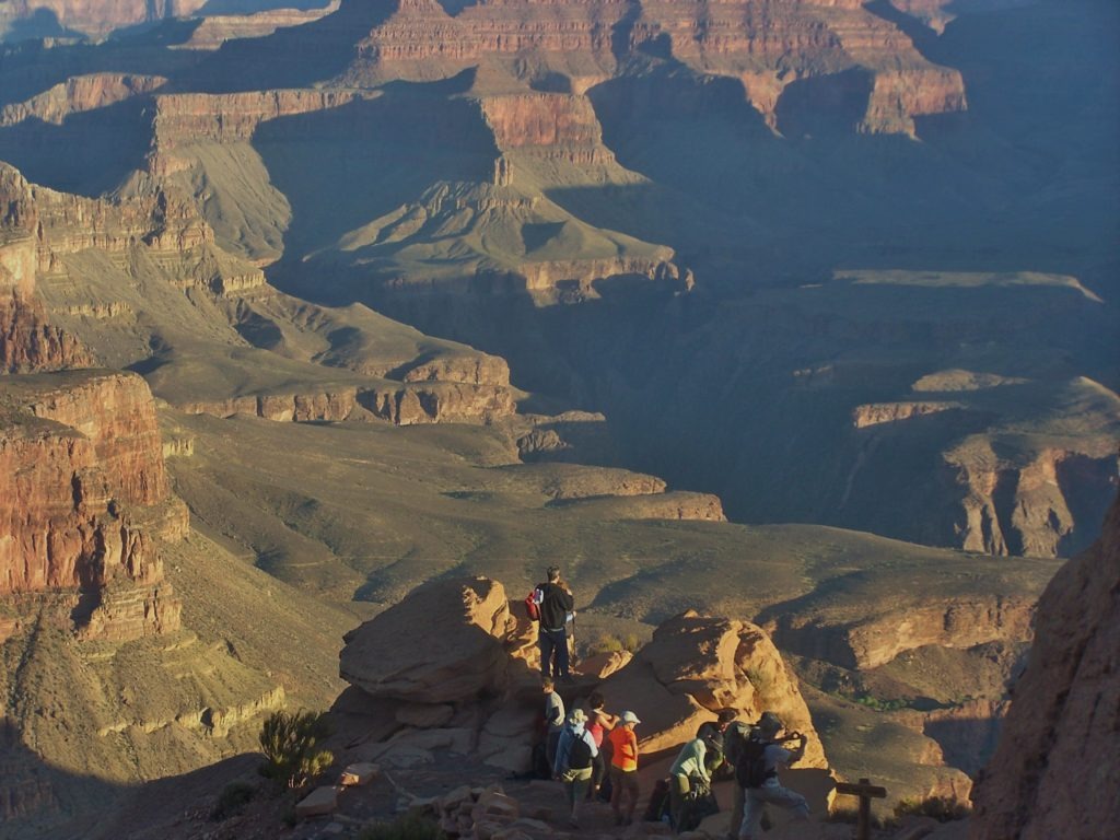
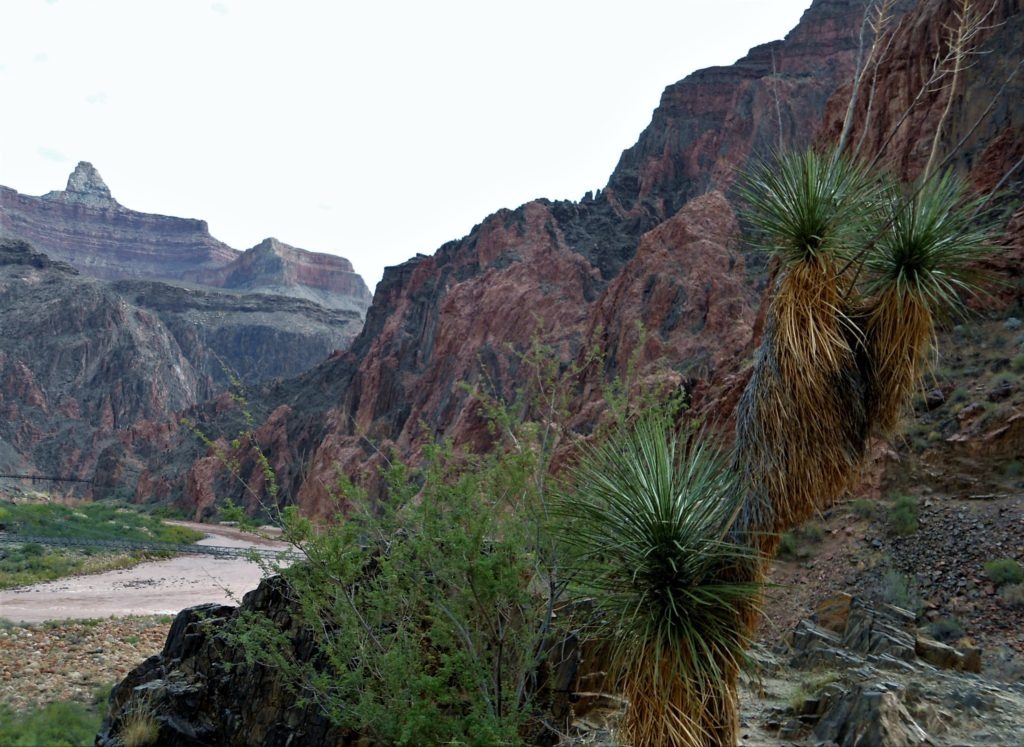
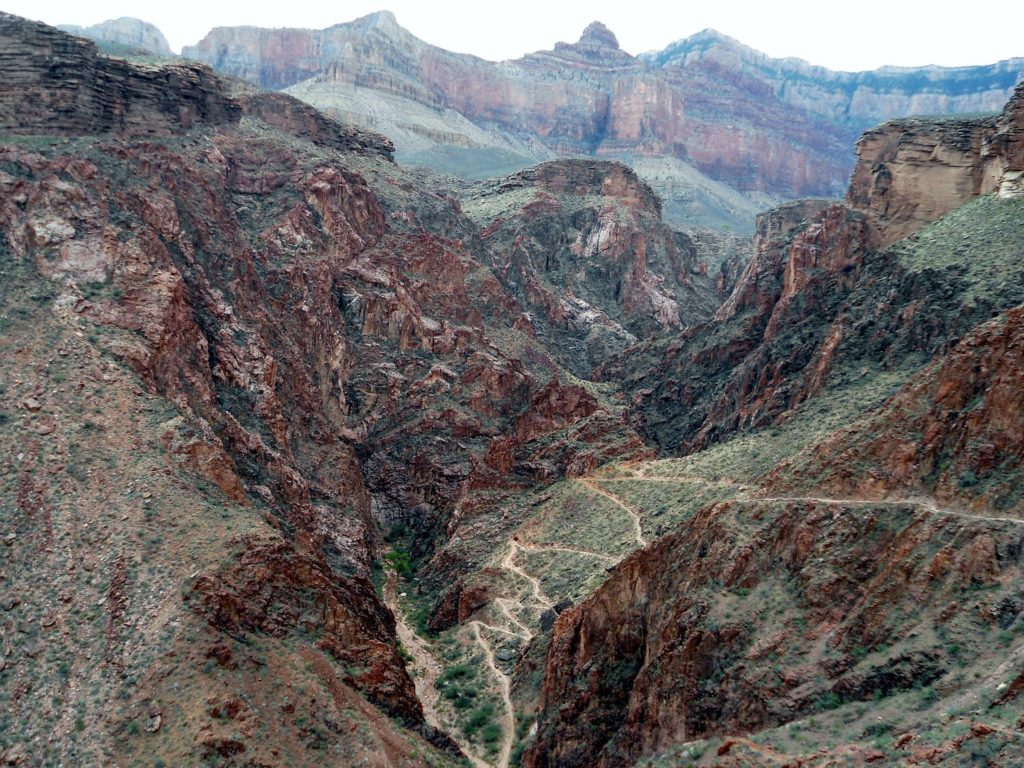
The trail mellows out a bit as it meanders down the Tonto Plateau–the flattest layer of the Grand Canyon. You’ll catch your first glimpse of the Colorado River around the Tipoff (pit toilet and emergency phone). Once you reach the lip of the plateau, the trail makes its final drop down to the river.
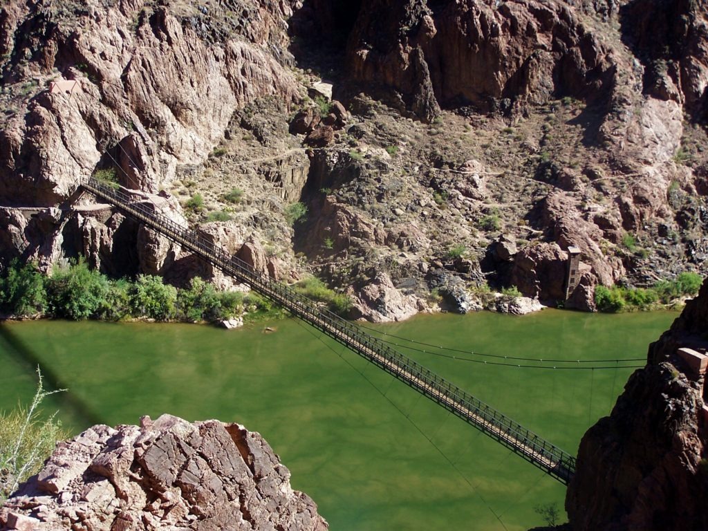
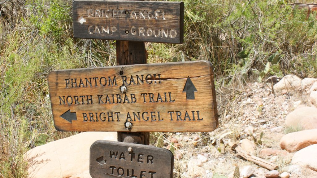
Stay on South Kaibab Trail. It cuts through a short rock tunnel and then crosses the Colorado River on the Black Suspension Bridge. Congratulations, you’ve made it to the bottom of the Grand Canyon! Feel free to drop down to the river around the Phantom Ranch Boat Beach (no swimming). To finish the first leg of the loop hike, continue on the Kaibab Trail (now North Kaibab) a half-mile to Bright Angel Campground and another .4 miles to Phantom Ranch.
South Kaibab Mileage & Elevation
South Kaibab Trail loses nearly 5000 feet in elevation on its way to the bottom of “The Big Ditch.” Plan on the hike taking approximately 3-6 hours, depending on your pace and the number of pictures you take.
- Trailhead to Ooh Aah Point (.9 miles/-600 ft elevation)
- Ooh Aah Point to Cedar Ridge (.6 miles/-540 ft elevation)
- Cedar Ridge to Skeleton Point (1.5 miles/-920 ft elevation)
- Skeleton Point to the Tipoff (1.4 miles/-1220 ft elevation)
- Tipoff to Black Suspension Bridge (2.1 miles/ -1270 ft)
- Colorado River to Bright Angel Campground (.5 miles):
- Bright Angel Campground to Phantom Ranch (.4 miles)
- Total: 7.4 miles/ ~4860 feet elevation loss
Phantom Ranch by day
Phantom Ranch is a place to relax and mingle with other hikers and travelers. Those with overnight reservations can check in to claim their bunk or cabin. You’ll be sharing the grounds with river rafters, backpackers, day hikers, and visitors arriving on mule trips.
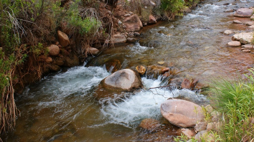
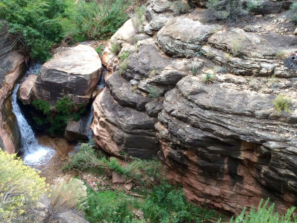
Most people will want to take it easy after the hike down. Maybe a shower and a nap is in order? If you’re feeling social, hang out by the water station or grab a seat in the air-conditioned canteen to swap travel stories (and beers) with whoever trickles in. If it’s hot, consider lounging around in Bright Angel Creek for part of the day–that’s where we headed to keep cool on a 108 degree June day.
Feeling more ambitious? Make your way back to the Colorado River to check out the rapids and whitewater rafts (no swimming). You can also add another day hike if you’ve got it in you. Side trip options will be limited in summer–it gets brutally hot down here. Ask the rangers about shorter hikes. [Note: Ribbon Falls is the signature day hike from Phantom Ranch; however, that hike–an 11-mile round-trip–usually requires a two-night stay, unless the weather is mild and you’re the baddest of badasses.]
Phantom Ranch by night
Evenings are low key. If you ordered dinner in advance (see menu and meal reservations), you can join other travelers for a well-earned meal. Rangers normally put on evening programs (e.g. Grand Canyon history, geology, wildlife, black-light scorpion walks).
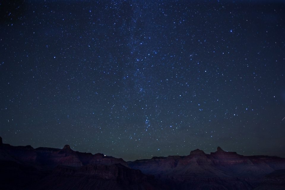
The canyon is pretty mesmerizing at night. Be sure to pack a head lamp. For sunset views, wander back towards the Colorado River–you’ll get better vantage points from the bridges or far bank (River Trail). Its okay to go to bed early–you’ve got a big hike out in the morning. But make sure to spend some time outside after dark to experience the canyon’s eerie silence and unbelievable star-gazing:
Phantom Ranch up to South Rim
On your return journey, you’ll work your way back up to the South Rim via the park’s main artery trail, the Bright Angel Trail. Eat a big breakfast. Hydrate. And get an early start. The hike up is much harder than the hike down.
Directions: From Phantom Ranch, you will backtrack (towards the Colorado River) to Bright Angel Campground (.4 miles). Look for the Bright Angel Trail sign (to join the River Trail). From this point, it’s a 9.5 mile hike up to the South Rim.
River Trail to River Resthouse/Bright Angel Trailhead
Your first mile-and-a-half is a relatively easy warm-up on the River Trail: a short, connector trail between Bright Angel Campground and the Bright Angel Trailhead. The River Trail meanders through some National Park buildings and then crosses the Colorado River via the Silver Bridge. You’ll follow the river for a bit, trudging through a mile-plus of sand dunes, until you reach River Resthouse (toilets, no water).
Bright Angel Trail: Colorado River to Indian Gardens
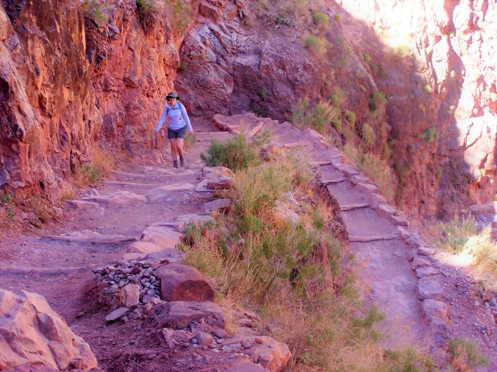
Bright Angel Trail officially begins at River Resthouse. Here, Bright Angel Trail leaves the Colorado River, gradually working up a terrace along a desert wash (Pipe Creek). Enjoy this last bit of easy hiking–you’ll soon start an aggressive climb at Devil’s Corkscrew, a series of exposed switchbacks that get dangerously hot in the summer sun.
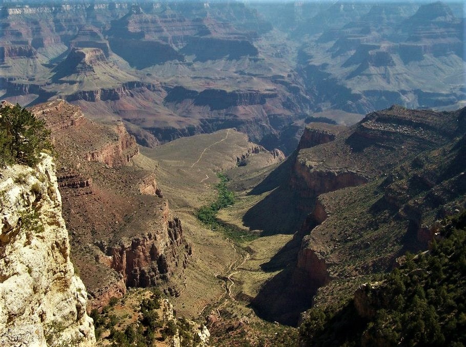
You won’t experience the panoramic vistas of the South Kaibab Trail on Bright Angel Trail. However, you’ll see considerably more plant life and animal life on the trail’s lower half, thanks to Pipe Creek drainage and Garden Creek, a spring-fed creek that runs for a few miles below Indian Garden.
This lower section of the hike is pleasant. For one thing, the Tonto Plateau is relatively flat, which makes for easier walking. It’s also surprisingly lush for the desert. With perennial water and trees, this area has long been an oasis for people and animals, especially Indian Gardens–the midpoint of Bright Angel Trail. It’s an ideal spot to get off your feet in the shade of cottonwood trees, refill your water, and refuel for the big push to the top.
Bright Angel Trail: Indian Gardens to South Rim
Most of the elevation gain on Bright Angel Trail is concentrated in the top four miles of the hike. Not far above Indian Gardens, you’ll hit several sets of switchbacks, starting with “Jacob’s Ladder.”
From here on, Bright Angel Trail is basically an endurance test. Switchback by switchback, you’ll climb about 3,000 feet over the last four miles.
Thankfully, the National Park Service has built resthouses at the 3-mile mark and 1.5 mile mark, so you can replenish your water (seasonal), bum some shade, and get off your feet. (It’s a good idea to stop a few times, elevate your legs, and pound some salty snacks at this point.) From the last resthouse, you’ll climb the last 1,131 feet on some long switchbacks that will take you up to the crowded overlooks of Grand Canyon Village. It’s a bucket-lister.
Bright Angel Mileage/Elevation
The hike up Bright Angel Trail (8.0 miles) via the River Trail (1.9 miles) is slightly longer than South Kaibab Trail. The hike up generally takes twice as long as the hike down. Strong hikers might average 2+ mph going up; weekend warriors might average 1 mph, given the elevation gain. Park rangers estimate the average time to be 7-8 hours.
- Phantom Ranch to Bright Angel Campground/River Trail (.4 miles)
- River Trail to River Resthouse/Bright Angel Trail (1.5 miles)
- River Resthouse to Indian Garden (3.1 miles/ 1320′ elevation gain)
- Indian Garden to 3-mile Resthouse (1.8 miles/ 948′ elevation gain)
- 3-mile to Mile-and-a-half Resthouse (1.5 miles/ 981′ elevation gain)
- 1.5-Mile Resthouse to Rim/Trailhead (1.6 miles/ 1131′ elevation gain)
- Total: ~ 9.9 miles/4460′ elevation gain
Phantom Ranch Reservations: Tips & Links
Given the distance and change in elevation, you’ll definitely want to train for this hike. Even then, strong hikers may struggle with the heat, sun exposure, dehydration, elevation, and fatigue–especially if they’re not acclimated to desert hiking. However, the hiking isn’t the only challenge. Most people need to start their trip planning many months in advance to pull off this overnight trek.
If you want to spend the night below the rim, you either need a backcountry permit for camping (backpacker option) or an advanced reservation at Phantom Ranch (day hiker option). Phantom Ranch has the only beds below the rim of the Grand Canyon.
Phantom Ranch reservations are only available through a lottery system. It’s possible to luck out on late reservation requests, especially at less desirable times of year. For the best odds, however, you should enter the lottery 15 months prior to your proposed stay on the first day of the month. For complete details, check out the official Phantom Ranch Lottery Policies and Frequently Asked Questions.
Here are some other links that might also help with your Grand Canyon trip planning:
- Pre-/Post-Hike Lodging: Lodging on the South Rim
- Pre-/Post-Hike Lodging: South Rim Campground Reservations
- Phantom Ranch Reservations
- Phantom Ranch meal reservations (order at same time as lodging)
- Hikers’ Express Shuttle (early mornings) to South Kaibab trailhead.
- Bus routes for South Rim Shuttle (orange route to S. Kaibab)
- Grand Canyon weather and road conditions.
- Would you prefer to camp below the rim? See backcountry permit procedures and fill out a Backcountry Permit Request form.
- To prepare for your trip, browse the National Park Service’s Hiking Tips and Hiking FAQs for the Grand Canyon.
Hiking safely in the desert
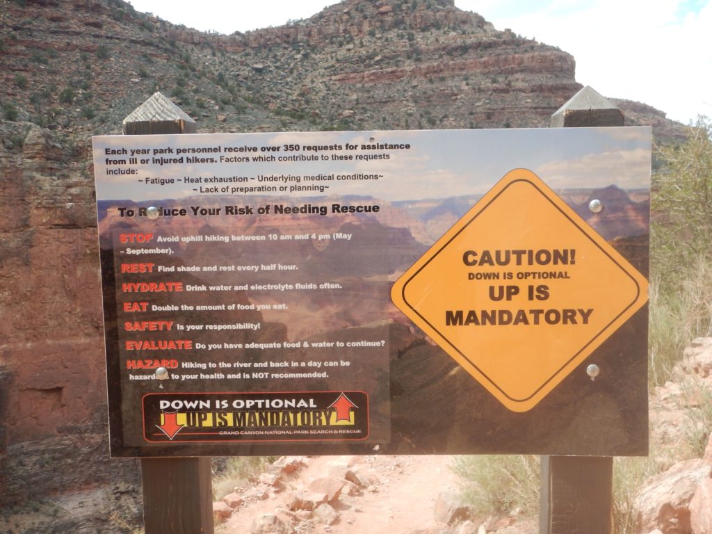
Each year, Grand Canyon rangers respond to more than 300 safety calls from unprepared (or over-confident) hikers. Almost everyone who hikes in the Grand Canyon for the first time finds it more extreme than they expected. Before your trip, study the National Park Service’s Grand Canyon Hiking Tips and prepare for extreme temperatures (that can fluctuate 70 degrees from the rim to the river across the day).
In this environment, you should expect the best, but plan for the worst, to make sure you have a good trip. Here are a few safety tips:
- Water. Remember, there is no water access on South Kaibab Trail. Other water stations are seasonal (Bright Angel Trail). Always carry extra water–the park’s dated water network breaks down regularly.
- Falls & injuries. The South Kaibab and Bright Angel trails are the best maintained trails in the Grand Canyon. You won’t be tiptoeing along narrow cliffs with thousand-foot drops–the corridor trails are relatively wide with predictable footing. Still, stumbling at certain spots could result in serious injuries or even death. Be careful, and you’ll probably be fine.
- Rattlesnakes. Rattlesnakes are common in the Grand Canyon, but they rarely strike unless threatened. Watch where your place your feet and hands–and keep in mind that snakes and scorpions are most active at night during hot parts of the year (pack a headlamp/ flashlight).
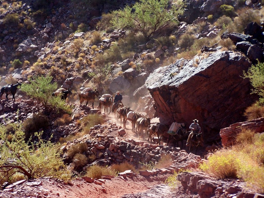
- Mule Trains. Hikers must yield to mule trains (which you’ll meet on both trails). Step off the trail to the uphill side and follow the wrangler’s instructions.
Grand Canyon for “one-percenters”
It’s impressive gazing down on the Grand Canyon from the park’s scenic overlooks. In many ways, however, the canyon is more grand from below as you’re looking up at thousands of feet of layered cliffs towering above you.
The problem is, most people never the leave the rim. According to the National Park Service, just 10% of visitors hike at least a mile into the canyon. Only 1% make it down to the Colorado River. And only 1% spend a night in the canyon. These are the “one-percenters.”
Do you want to be a “one-percenter”? The South Rim to Phantom Ranch Loop is the best option for your first hike to the bottom of the Grand Canyon. If you plan your trip early and come prepared, you’ll love this bucket list hike.
Happy Hiking!