Labyrinth Canyon: Flatwater Paddling in Southern Utah
Labyrinth Canyon is one of the signature flatwater paddling destinations in the Southwest. The paddling itself is easy, but you need to be well-prepared and self-sufficient to tackle this remote and scorched landscape in a canoe or kayak. Here’s a quick guide for paddlers looking to float this scenic stretch of the Green River in southeastern Utah.
Labyrinth Canyon, Green River
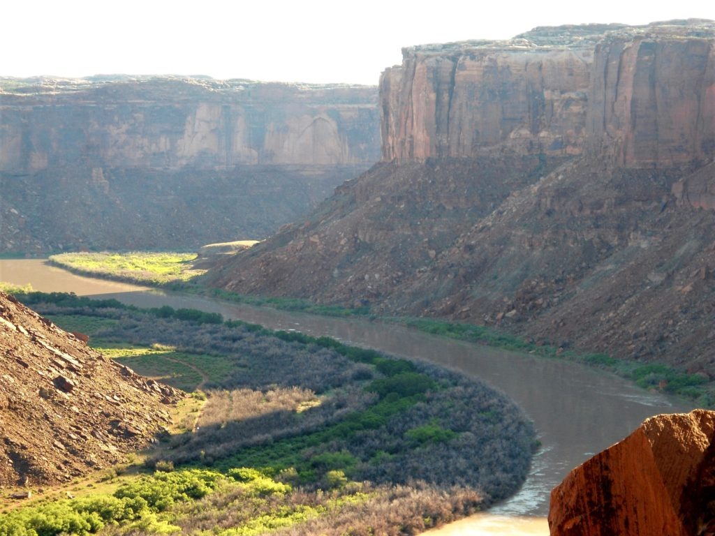
The Green River begins in Wyoming’s Wind River Range and meanders down the Colorado plateau until it reaches its confluence with the Colorado River in southeastern Utah. Labyrinth Canyon is a section of the lower Green River that flows through a “labyrinth” of sandstone cliffs west of Moab. (Here’s a basic map.) The canyon ends at Mineral Bottoms boat ramp, just outside the northern boundary of Canyonlands National Park.
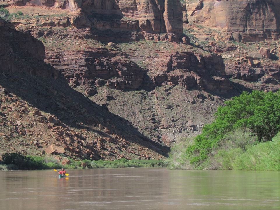
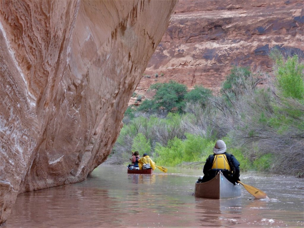
Labyrinth Canyon is a flatwater trip. The Green River can flow quickly here–especially from late May to mid June. But there aren’t any rapids and hardly any riffles. Just a few eddy lines that might tip a kayak or canoe if you hit them wrong.
You don’t need advanced paddling skills for this trip. (For a whitewater trip on the Green River, head upstream to Desolation Canyon or downstream to Cataract Canyon for world-class whitewater on the Colorado River.) The paddling may be easy, but you should have some backcountry skills (and trip planning skills) to manage the risks of wilderness paddling in a rugged and remote environment. If you have an emergency out here, you’ll probably be on your own for several days in a desert environment that’s too harsh for most people, plants, and animals.
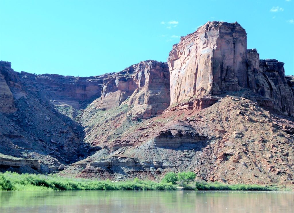
That’s the draw of Labyrinth canyon. Solitude. Steep canyon walls. And days of scenic paddling through a stark landscape that few people get to see.
Trip Options
For most people, Labyrinth Canyon is a 3-5 day paddle trip. At high water, you might plan on 15-20 mile days. At low water, estimate 10-15 miles per day as a comfortable pace. You can choose between a 68-mile or 45-mile trip:
- Green River to Mineral Bottoms. Launch from Green River State Park in the town of Green River, Utah (small fee) for a 68-mile float trip. Allow for at least 3-4 days of paddling to reach the take out at Mineral Bottom boat ramp. The upper stretch of this trip passes Crystal Geyser–a cold water geyser that spouts every 12-16 hours. However, the 23 miles of river between the town of Green River and Ruby Ranch mostly borders private property (limited camping) and is not as scenic as the stretch downstream of Ruby Ranch.
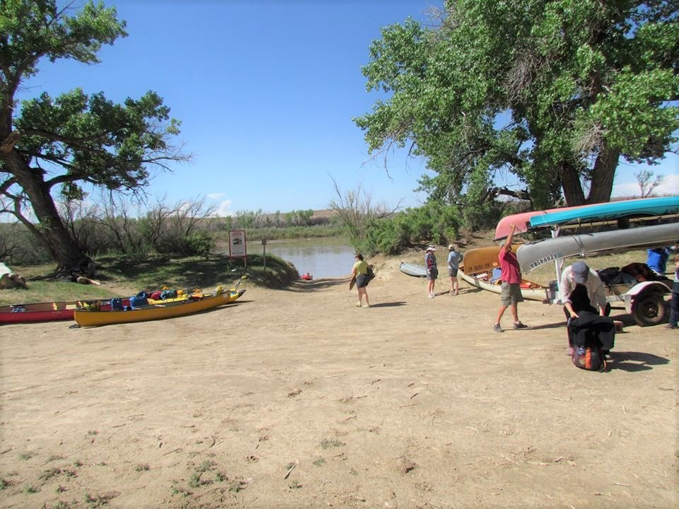
- Ruby Ranch to Mineral Bottoms. The most popular trip is the 45-mile float from Ruby Ranch to Mineral Bottoms. Ruby Ranch is on private property. However, paddlers can access their boat launch for a small fee: $10/boat plus $5/person (fee box: cash only, exact amount required). Within a few miles of the boat launch, you’ll enter a labyrinth a red rock cliffs, buttes, mesas, and riparian shorelines until the take-out at Mineral Bottoms boat launch.
Paddling the Labyrinth
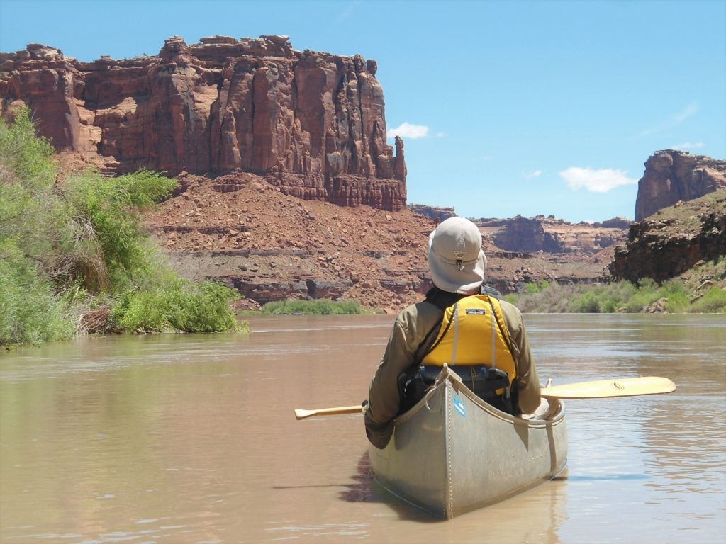
Our group opted for the 45-mile trip from Ruby Ranch to Mineral Bottoms. Within a couple miles of the boat launch, we drifted out of ranching country into classic Utah canyon country.
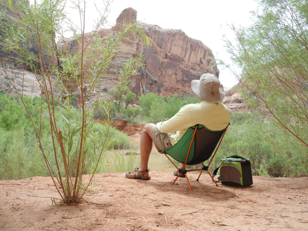
We spent 3 nights on the river–with two short days and two moderate days of paddling. You could race through the canyon in a day or two, especially at high flows. But that’s not the point of this paddle. Most people make this a casual trip to savor the red rock cliffs as they meander through the canyons by day and lounge around riverside campsites by night.
Labyrinth Canyon ends at Mineral Bottoms boat ramp (river left). Everyone must exit the river here–unless they charter a jet boat shuttle and secure additional permits to continue through Stillwater Canyon and Canyonlands National Park to the confluence of the Colorado River.
Labyrinth Campsites & Side Trips
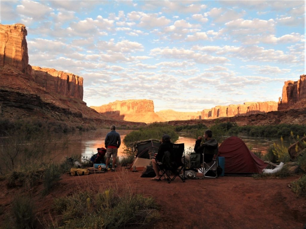
Your access to the canyon’s undeveloped campsites varies by season and water level. At low water levels–typically mid-summer to fall–you can expect relatively easy access to sandbar and riverside camping. Your camping and side trip options may be limited by mud, quicksand, or vegetation. At high water, it’s extremely difficult to find spots to camp. The shoreline is steep and choked with thickets of invasive tamarisk trees. (If you pass up one small opening on the bank, for example, you may be 7-10 miles away from the next accessible camp site.) We paddled at record flows (well over 25,000+ cfps) and were lucky to get into three small campsites.
But each of them had stunning canyon views:
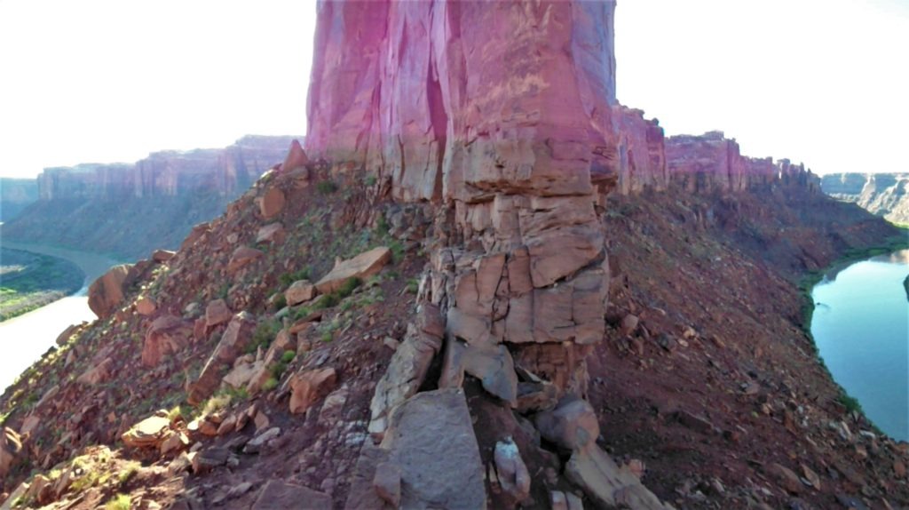
Active paddlers can hike up some desert washes and side canyons. (It may take some canyoneering skills to bushwhack and scramble too far, however.) Many boaters hike up to Spring Canyon Point for a scenic view of Bowknot Bend–a 7.5 mile bend where the Green River comes within 1200 feet of doubling back on itself. You can reach this scenic overlook with a steep but accessible hike with a little scrambling.
High water also opens up some exploratory paddling in some side canyon creeks and riparian backwaters, including Barrier Creek:
Logistics & Planning
This is an enjoyable wilderness trip that requires careful planning to manage the risks of wilderness paddling in a remote, desert environment. Here’s a quick guide to get you started on your trip:
- Permits. Every paddler must have a (free) permit to paddle Labyrinth Canyon. Download your permit here. Trip leaders must carry approved permits on the Green River.
- Water. The Bureau of Land Management strongly advises that paddlers carry in all drinking water. A rule of thumb is one gallon of drinking water per day per person–plus cooking water. Please note: The Green River contains high levels of silt and salt that’s hard to filter (as well as uranium deposits, arsenic, and other poisonous metals). The BLM reports that most emergency rescues in Labyrinth Canyon stem from dehydrated paddlers who try to filter their water instead of carrying it in.
- Leave No Trace. As noted on the permits, each group is required to carry (1) a metal fire pan and (2) a leak-proof, reusable toilet system.
- Navigation. I highly recommend a quality river map to help chart your progress, estimate speed, and spot landmarks–especially the Mineral Bottoms take-out. (If you pass it, you’re screwed.) Electronic navigation might supplement printed maps, but phone coverage is non-existent and satellite access sometimes blocked by deep canyons.
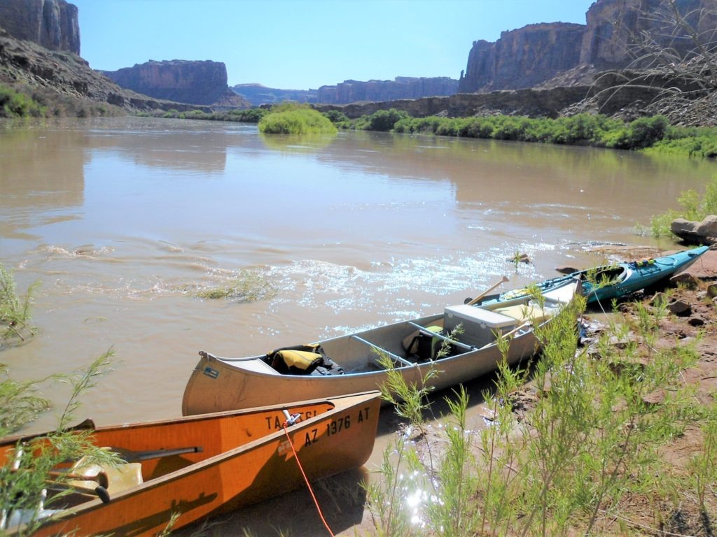
- Boat Recommendations. This is an ideal canoe trip. Touring kayaks will handle this water well, but it’s tough to do this route without a canoe or raft. (The extra water weight is one challenge–then there’s the issue of strapping a toilet to the back of a kayak!?!) Rafts, duckies, and packrafts are slower options.
- Shuttles. It’s possible to organize a group self-shuttle–see map; however, each leg of a self-shuttle can easily take eight hours of driving/waiting time. You can shave several hours off each leg with a commercial shuttle to/from Moab. This also leaves the off-road driving and sketchy road in and out of Mineral Bottoms to the locals. I recommend going with a local outfitter if you can afford it.
Trip Rating
I really enjoyed this trip. I would have welcomed a few rapids–and wish I would have done more advanced research on side hikes and Native American sites. But our group enjoyed the ever-changing views of the canyon and some truly world-class campsites. Really, everyone should experience canyon sunsets and sunrises. The eerie quiet was also memorable–the loudest sound I heard over four days was the whirring wings of a dive-bombing falcon. I’d happily return to Labyrinth Canyon for a second trip–or continue down the Green River through Stillwater Canyon and Canyonlands down to the Colorado river confluence.
This is a great flatwater paddle trip. I say go for it!
2 Replies to “Labyrinth Canyon: Flatwater Paddling in Southern Utah”
Can you share the coordinates of your 3 campsites? Would love to do this trip this fall.
Hi, Jojo-
I didn’t have electronics with me on the trip and no longer have the river maps we used. But here’s rough directions to our three campsites, which should be useful once you have a trip map: (1) Trin Alcove Bend/Three Canyon (~ River Mile 90 on river right); (2) top side of Bowknot Bend (~ River Mile 69.5 on river right); (3) near the mouth of Horseshoe Canyon (no mileage, but it’s an obvious campsite on river left around the mouth of Horseshoe Canyon that’s maybe six miles above take out at Mineral Bottoms).