Wilsons Prom: Australia’s Underrated Bushwalk
Wilsons Promontory is no secret. It’s one of the most popular backpacking destinations around Melbourne. Outside the state of Victoria, however, many Australian bushwalkers and international travelers haven’t heard of “the Prom.” It doesn’t make bucket lists of the world’s best hikes, like Tasmania’s Overland Track, or get the same hype as Victoria’s Great Ocean Walk. But Wilsons Prom is clearly one of Australia’s best bushwalks. Here’s why active travelers should consider backpacking the southernmost peninsula of mainland Australia.
Wilsons Promontory
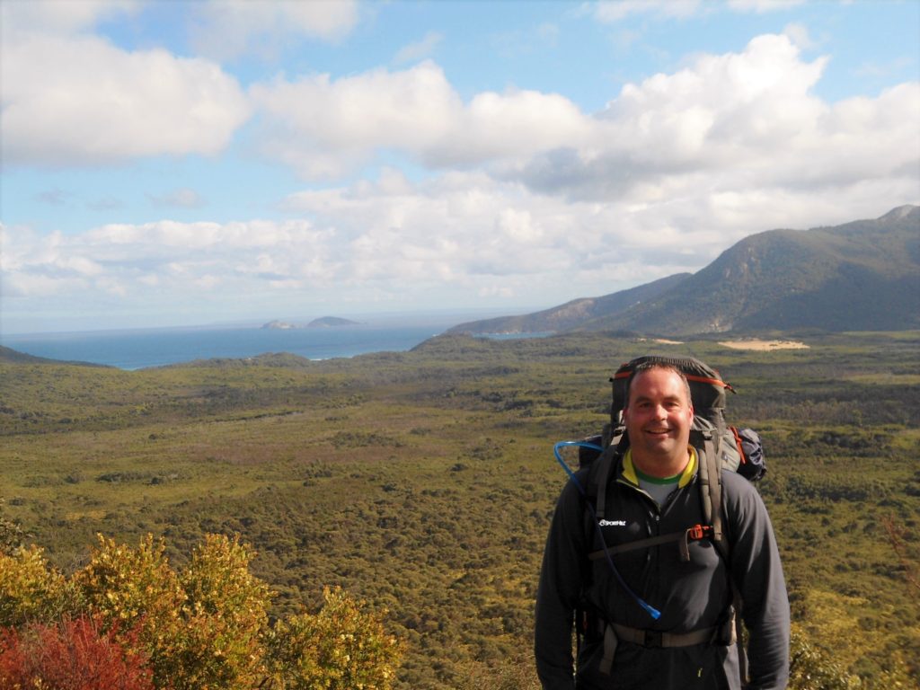
Wilsons Promontory National Park lies about 3 hours southeast of Melbourne, Australia. The Prom juts into the temperamental waters of Bass Strait, forming the southernmost tip of mainland Australia. Many visitors book campsites or cabins at Tidal River to walk the white sands of Squeaky Beach and day-hike Mt. Oberon. But the real draw to Wilsons Prom is the backpacking.
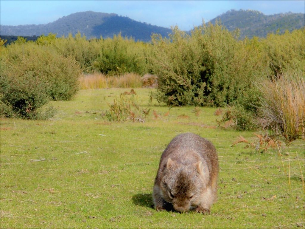
Wilsons Prom boasts a strong network of bushwalking trails and backcountry campsites. There’s no shortage of boulder-lined beaches, secluded sea coves, and ocean overlooks along the backcountry trails. Australia may be the world’s driest continent, but lush rainforests cover the Prom’s coastal mountains. The Prom is also home to Mountain Ash trees–the second tallest trees in the world. The park’s interior grasslands and coastal heath are less dramatic, but they’re home to wombats, wallabies, kangaroos, and emus. All together, the water, the green, the landscape, and the wildlife make Wilsons Prom one of Australia’s top hiking destinations.
Southern Circuit–Wilsons Prom
Any overnight hike in Wilsons Promontory National Park requires a permit and advanced booking of all campsites. (Here’s the link to book campsites online.) The most popular entry-level bushwalk is the out-and-back hike to Sealers Cove (1-2 nights). The most popular backpacking route is the Southern Circuit (map here). The Northern Circuit (map here) is less developed and requires off‐track navigation experience. We opted for a four-day version of Wilson Prom’s Southern Circuit with a night at the lighthouse:
- Tidal River to Oberon Bay (7.6 km)
- Oberon Bay to Wilsons Promontory Lightstation (15.6 km)
- Wilsons Prom Lightstation to Refuge Cove (18.1 km)
- Refuge Cove to Tidal River (20.6 km)
Many bushwalkers hike the Southern Circuit clockwise in a ~40 kilometer loop that begins and ends at Telegraph Saddle. In contrast, we backpacked the Southern Circuit counter-clockwise in a ~60 kilometer loop that began and ended at Tidal River. Here’s a quick overview of our route to help with your trip planning and campsite reservations:
Tidal River to Oberon Bay
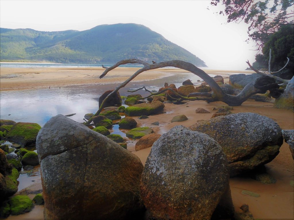
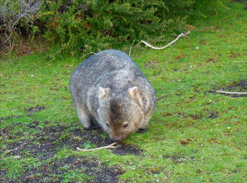
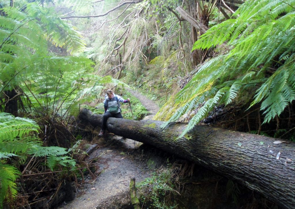
After a late start from Melbourne, we arrived at Tidal River in mid-afternoon. We had planned to day-hike Mt Oberon before starting our backpacking trip. With a late start and limited winter daylight, however, we picked up our hiking permits, snapped a few pictures of Laughing Kookaburras and Crimson Rosellas, and started the Southern Circuit. It took less than five minutes to spot our first wombat. Then our second. Third. Fourth. After heaps of photos, we headed into the forest for a bit before the trail veered west to trace the Prom’s western coast.
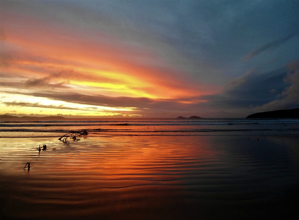
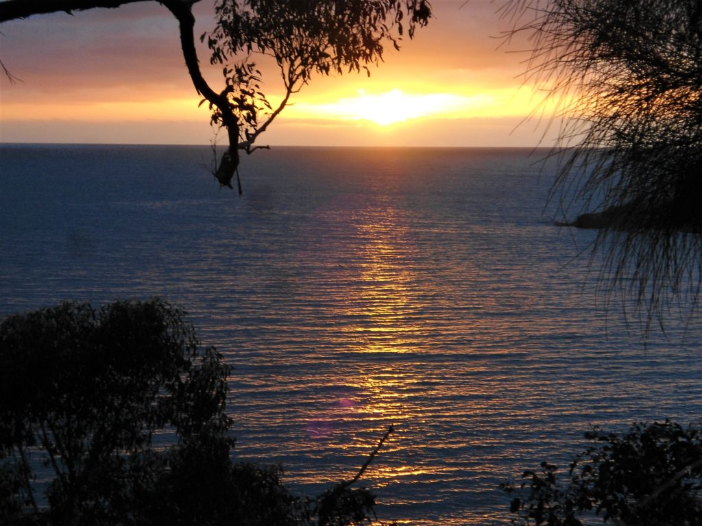
As we rounded a rocky point into Little Oberon Bay, the turquoise waves of Bass Strait washed onto a white sand beach flanked by orange boulders. We followed the coastal trail for a few kilometers as Little Oberon Bay opened into Oberon Bay. Our deserted campground was sheltered by small trees and a sand dune that blocked the winds off the ocean. At dusk, we had Oberon Beach all to ourselves as we watched the sun set over Bass Strait.
Oberon Bay to Wilsons Prom Lighthouse
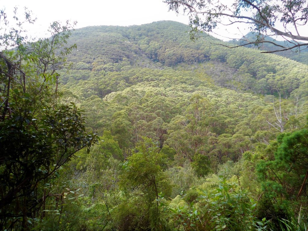
On day two, we crossed from the northwest coast of Wilsons Prom to the southeastern point of the peninsula. The park’s main interior track–Telegraph Track–wasn’t as scenic as the coastal track. Much of the track was jeep road, and big swaths of the park’s interior had been charred by bushfires. However, we spotted the occasional wallaby in the shrubs and enjoyed a few ocean views from an elevated section of the trail.
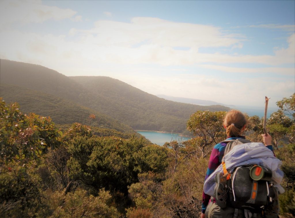
The hiking and scenery improved between Halfway Hut and Roaring Meg campsite as the coastal scrub gave way to fern gullies and forest. Roaring Meg is a creek-side campsite for backpackers who take a side hike to the southernmost tip of mainland Australia. That side trip tempted us; however, we continued southeast to Wilsons Promontory Lightstation. The approach to the lighthouse was some of the best scenery of the trip as the trail entered the rainforest and descended the coastal mountains that towered above the crashing surf of Bass Strait.
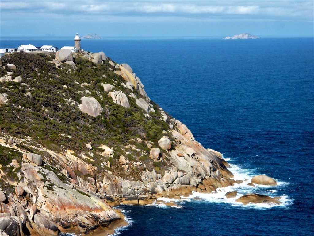
A night in the lighthouse keeper’s cottage was a nice splurge. Mrs. hikepaddletravel is a reluctant backpacker, so we booked a night at the lighthouse for a bed and shower (reserve a room in a cottage here). We shared some laughs, spaghetti, and alcohol with the Australians in our cottage. If you’ve visited lighthouses before, the lighthouse tour is nothing special. But the wombats were. Dozens of wombats live on the grounds around (and under) the lighthouse cottages. And almost all of them were willing to tolerate an (annoying) American crawling towards them for some close up pictures and wombat selfies.
Southeast Track: Lighthouse to Refuge Cove
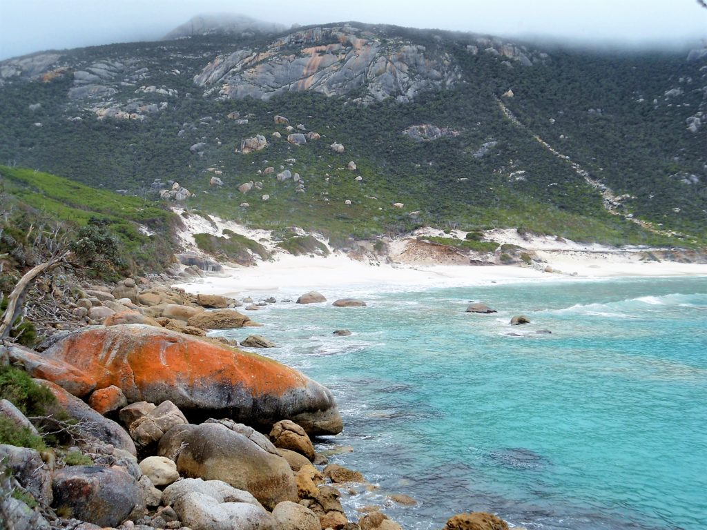
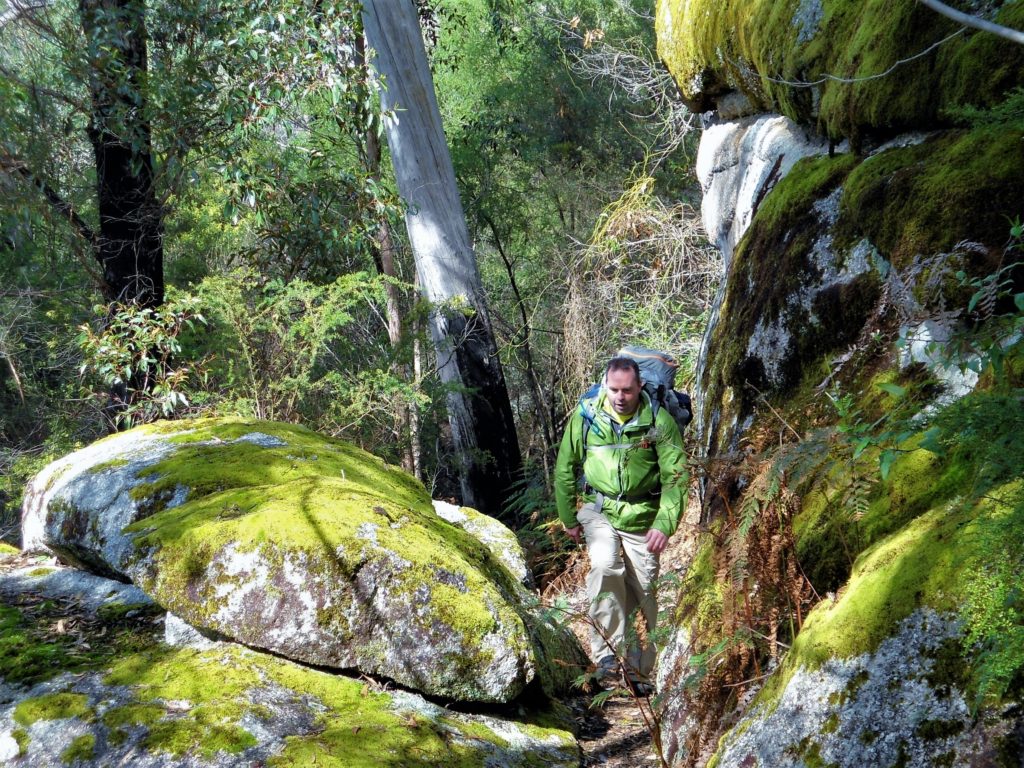
For us, the southeastern coast of Wilsons Prom was the best (and hardest) hiking of our trip. The Southeast Track climbed aggressively from the lighthouse up the mountains and stretched through miles of lush rainforest. This stretch of the trail was unusually green for Australia with its mix of mosses, ferns, and eucalyptus trees. It was also rugged as the rocky track meandered up, down, and around mountain ridges. None of these climbs were especially long or steep. But the accumulated elevation gain was significant. I’m not complaining–this hiking was heaps better than yesterday’s Telegraph Track.
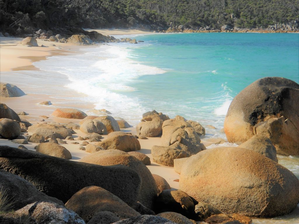
After slogging through ten kilometers of undulating mountain track, we dropped to sea level on the eastern shore of Wilsons Prom. The white sands of Little Waterloo Bay made for a scenic beach walk past blue-green surf and blonde boulders with auburn highlights.
After several kilometers of beach, the trail scaled more seaside mountains, topping out near Kersop Peak (729 ft elevation).
Mrs. hikepaddletravel was still going strong, but I was running out of gas by this point. (I didn’t have a GPS, but another hiker calculated the day’s accumulated elevation gain at 1155 meters/3789 feet.) Luckily, day three ended with a mild and scenic descent to Refuge Cove.
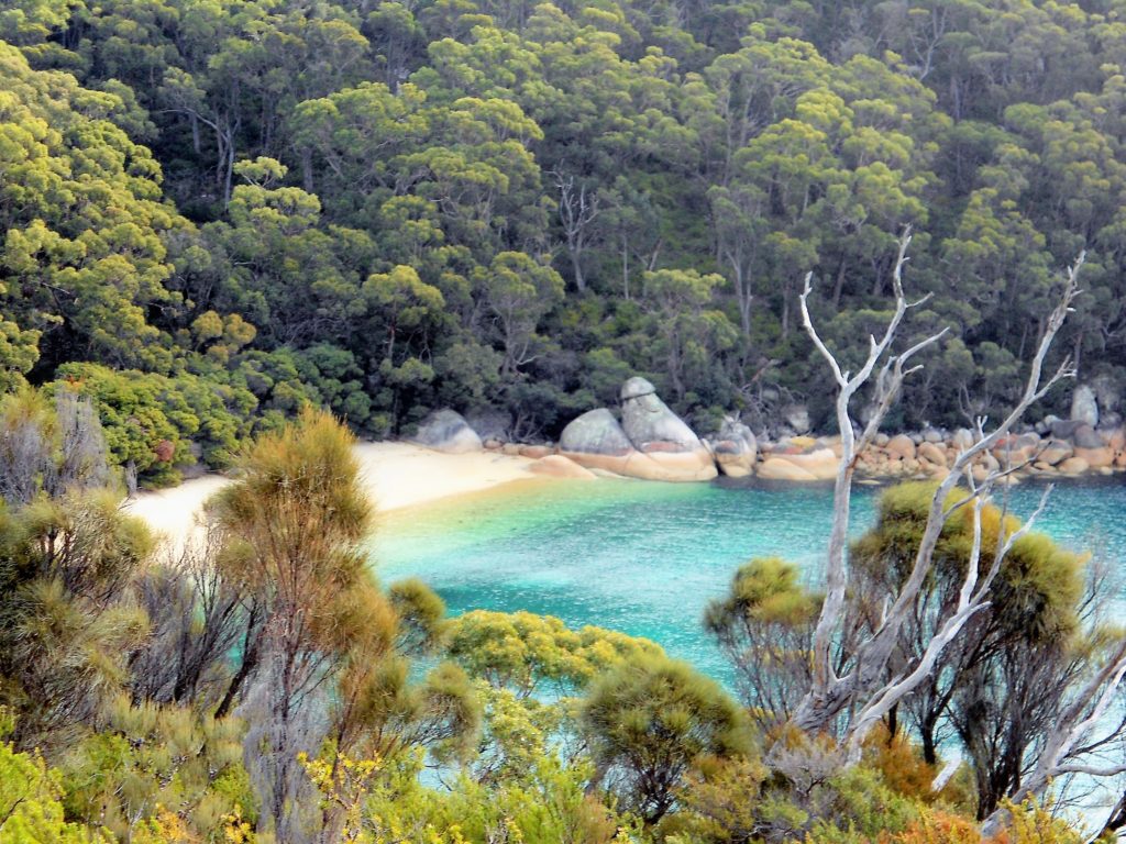
Refuge Cove to Sealers Cove
Refuge Cove is arguably the most scenic campsite at Wilsons Prom. It’s often overrun by bushwalkers and boaters during the summer. The cove is too cold to swim in winter, but we basically had the Refuge Cove campground to ourselves in August.
We woke up early on our last day to catch the sunrise over Bass Strait as we climbed above Refuge Cove through ferns and gum trees.
We didn’t see seals on the trip to Sealers Cove. However, we did catch a distant view of a whale and her calf from an ocean overlook. Forty-five minutes later, the whales surfaced within 100 meters of us, playing on the water’s surface for almost ten minutes.
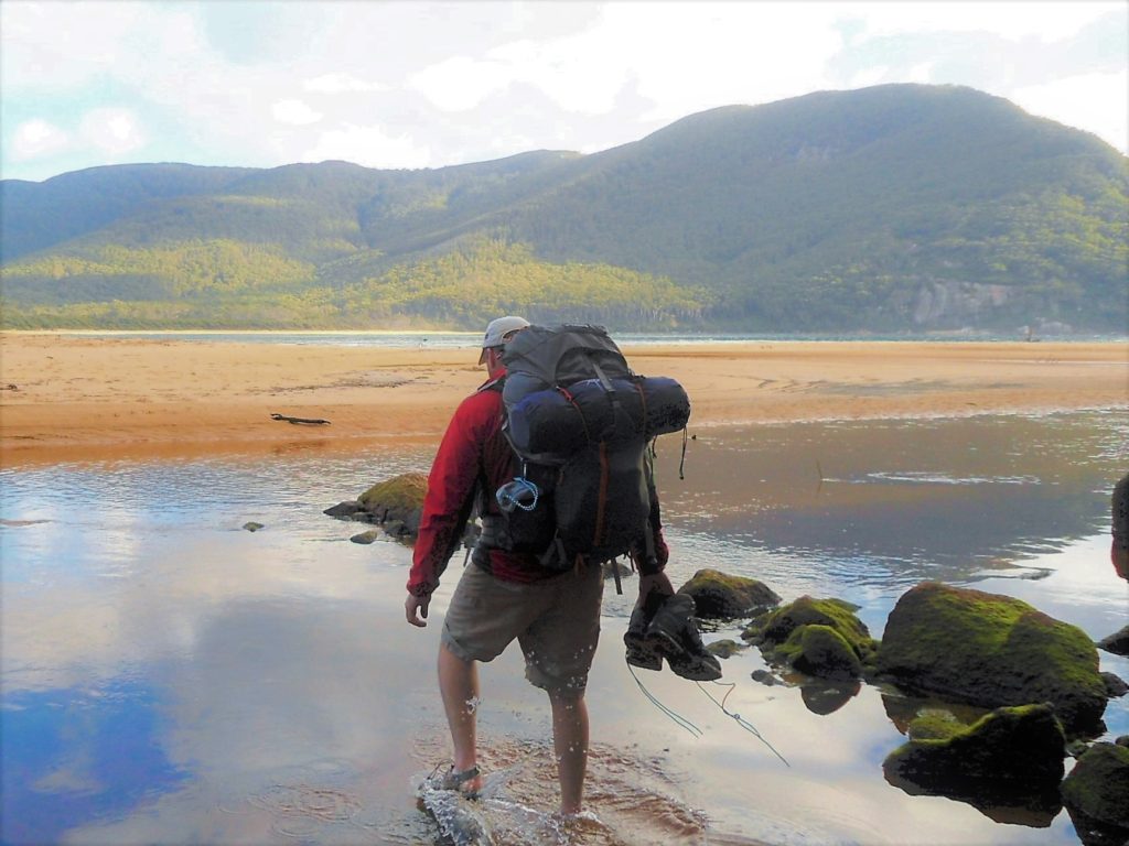
Our early start let us reach Sealers Cove at low tide. Sealers Cover is a scenic inlet (and summer swimming hole) with a tidal creek that’s difficult to cross at high tide. (Hikers should check the tide times at Sealers Cove before their trip.) We enjoyed an easy water crossing in our Keen water sandals.
Sealers Cove to Telegraph Track/Tidal River
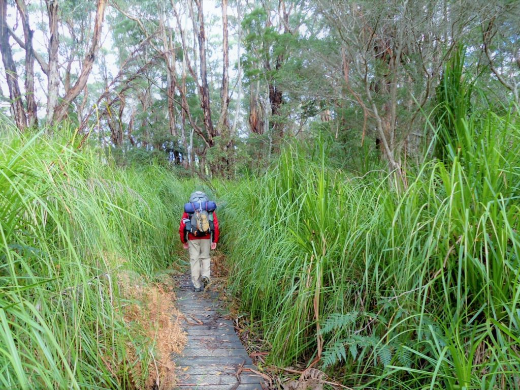
The walking track between Sealers Cove and Telegraph Saddle is the busiest section of Wilsons Prom. (It’s a potential out-and-back day hike.) West of Sealers Cove, a boardwalk leads hikers through a grass tree swamp:
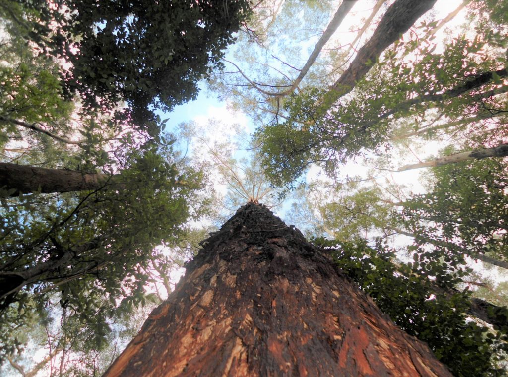
This landscape continued to change as the trail passed beneath a towering stand of Mountain Ash, a species of giant eucalyptus trees that approach the height of California Redwoods.
As we continued west, the trail gained another 1000 feet in elevation as it climbed towards Windy Saddle. From Windy Saddle to Telegraph Saddle you’ll enjoy panoramic views of mountains blanketed in eucalyptus.
Our trip ended at Telegraph Saddle, where I hitched a ride back to our car at Tidal River (4 km). (Shuttles operate in high season.) Our version of the Southern Circuit spanned approximately 60 kilometers of Wilsons Prom with 2750 meters (9000 ft) of accumulated elevation gain.
Route Recommendations for Wilsons Prom
Our route is not for everyone. Many backpackers plot shorter and easier days that limit their time on the trail and maximize their time in camp. I’m just the opposite. I tend to get stiff (and bored) in camp, so I try to maximize my trail time with more scenic and aggressive itineraries. Here are some tips to plan the route that’s best for you:
- Walking the Southern Circuit counter-clockwise (our route) is harder than walking clockwise. Hike clockwise from Telegraph Saddle to avoid the biggest climbs and hike downhill as much as possible.
- If you prefer easier trails (or have limited time), use Telegraph Track and the east-west interior trails that connect Telegraph Junction to Oberon Bay (west coast) and Waterloo Bay (east coast).
- If you prefer moderate hiking with more woods, mountains, and ocean views, avoid Telegraph Track and these interior trails as much as possible.
- Most backpackers prefer the campsites at Refuge Cove over Sealers Cove.
- Book a night at Roaring Meg campsite for a side trip to the southern tip of Australia.
- The ~40 kilometer circuits do not extend south of Waterloo Bay to the Southeast Track–our favorite section of the Southern Circuit (and the most difficult hiking). If you like rugged mountains and coastal rainforest, plan a route that includes the southeast point/lighthouse (even if you don’t spend the night there).
Logistical Tips & Safety
- Online Booking. Remember, you must plan your route in advance to reserve your campsites and overnight hiking permits online.
- Try to avoid peak season (December-January). Reserve campsites well in advance for summer trips, spring and fall weekends, and popular holidays (Labour Day, Easter).
- Many Australians prefer Wilsons Prom in shoulder season–February-March and October-November–for warm weather and smaller crowds.
- Low Season/Winter. Most Australians fear Victoria’s frigid winters (June-August)–when average temperatures drop into the mid-50s (12-13 C). If you’re not Australian, this may be mild (if not perfect) hiking weather. We loved the Prom in August, where we had temperatures in the mid-50s to low-60s (13-16 C), no snakes, and every beach, sunset, overlook, and campsite to ourselves.
- Each campsite has a water source (creek or rainwater tank). With seasonal droughts, however, these aren’t always reliable. Check the Parks Victoria website before your trip for updates on water availability, bushfires, and trail closures.
An Australian gem
Wilsons Prom doesn’t get as much press as some Australian national parks. But it’s right up there among the country’s best multi-day hikes. If you’re an active traveler or backpacker visiting Melbourne, it may be worth taking several days to experience one of Australia’s most underrated bushwalks.
Happy Hiking!