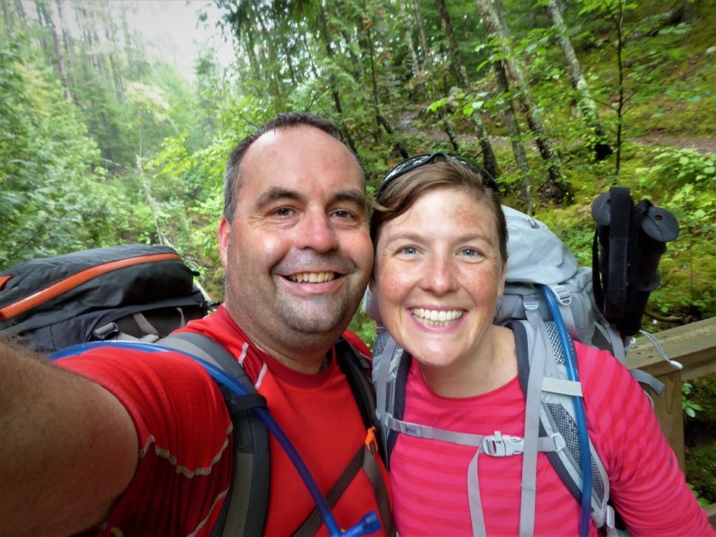
Superior Hiking Trail, Minnesota’s North Shore

There’s no Appalachian Trail or Pacific Crest Trail in the Midwest. But the Superior Hiking Trail along Minnesota’s North Shore offers some of the region’s best backpacking. Here’s my review of a three-day backpacking trip on the Superior Hiking Trail from Judge C.R. Magney State Park to Grand Marais.
Superior Hiking Trail–Overview
The Superior Hiking Trail flanks Lake Superior and scenic Highway 61 in northeastern Minnesota. The thru-hike section of the SHT stretches 255 miles from Duluth to the trail’s northern terminus near the Canadian border. The Superior Hiking Trail Association maintains the trail and offers local recommendations for thru-hikers, section hikers, and day hikers.
The SHT may be named after Lake Superior, but the trail only reaches the shores of Gichi-gami once. You’re not hiking rugged bluffs that loom directly above Lake Superior’s shore. Instead, you’re backpacking a few miles inland through mixed hardwoods and berry patches as the trail works across woods, bogs, and the ridges of small Minnesota mountains.
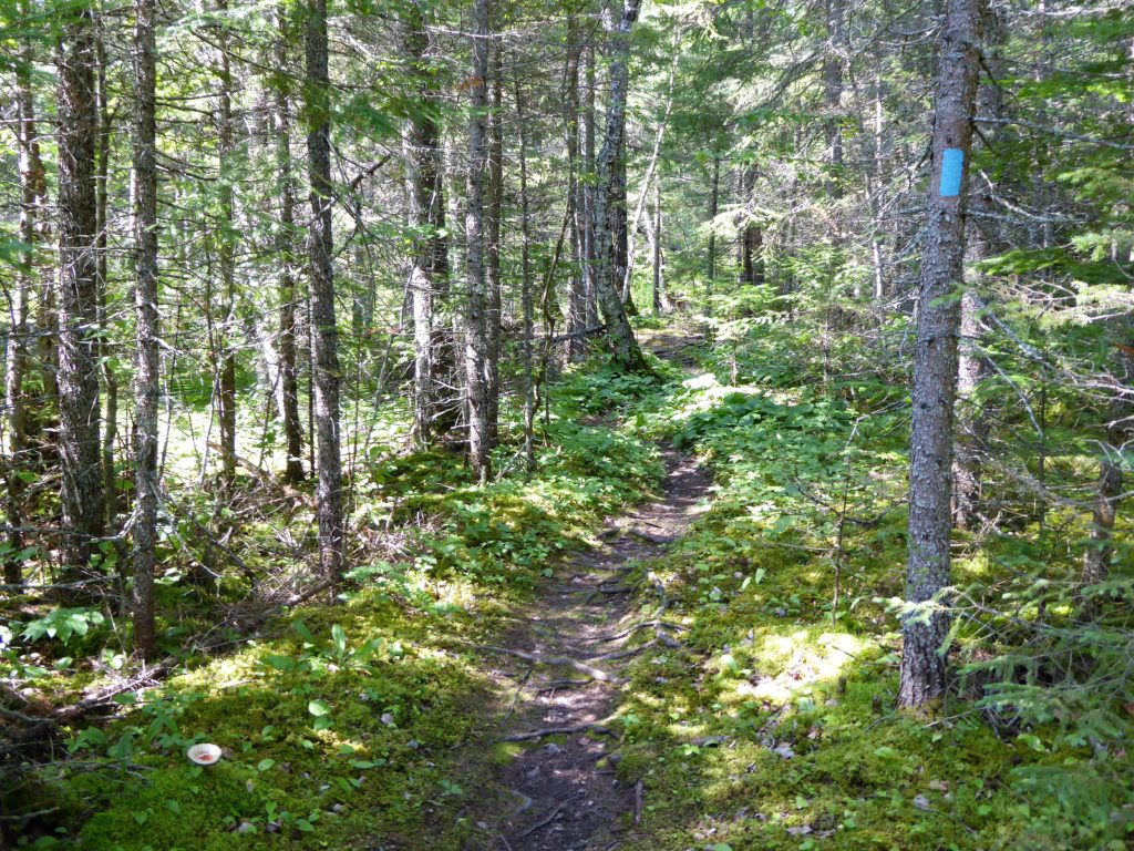
The Superior Hiking Trail is well marked with blue blazes and small plastic signs with the SHT logo. Major trail junctions are signed with mileage to campsites, waysides, and points of interest. You should carry a map (and GPS if you have it), but navigation is not difficult.
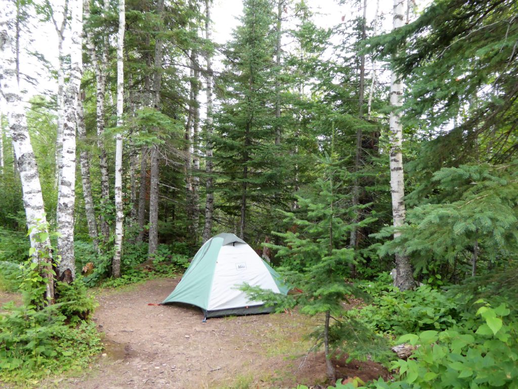
Backpackers will find dispersed camping sites clustered at 5-10 mile intervals on the trail. Each site includes 2-6 tent pads, a fire ring, bench seating, and back country latrine. We had our campsites to ourselves, but there’s an ethic of sharing sites with other backpackers. Most (but not all!) campsites are 100 to 200 yards from small rivers or creeks to refresh your water supplies.
Magney State Park to Grand Marais
Before committing to a thru-hike next year, we set out in August to sample a section of the Superior Hiking Trail. Looking for less traffic and more rugged hiking, we chose a route from Judge C.R. Magney State Park to Pincushion Mountain/Grand Marais. The Superior Hiking Association recommends this 24.6 mile route as a four-day, three-night backpack. We walked it in three days and two nights–and added a side trip to Devil’s Kettle Falls (3 miles) and a trek down Pincushion Mountain to our Grand Marais B&B via local ski and snowmobile trails (5 miles). We hiked 32-33 miles, walking north to south.
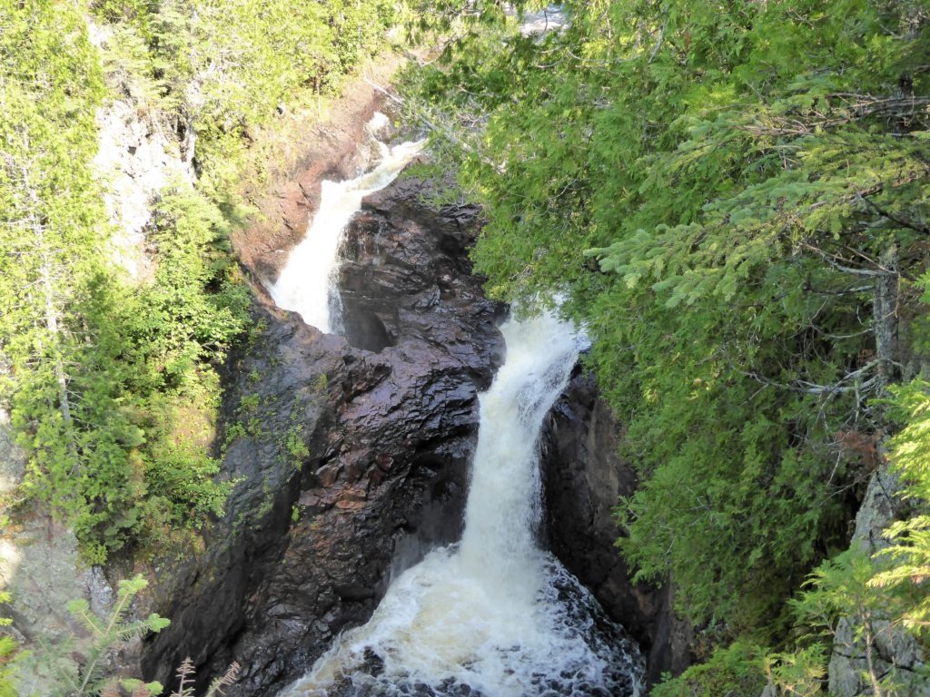
With a generous shuttle from Jay at Art House B+B in Grand Marais, we started at a Highway 61 wayside just north of the Magney State Park entrance. We began our hike with a three mile detour (1.5 miles out and back) to Devil’s Kettle falls–where the Brule river splits into a double waterfall with half of the river seemingly vanishing underground:
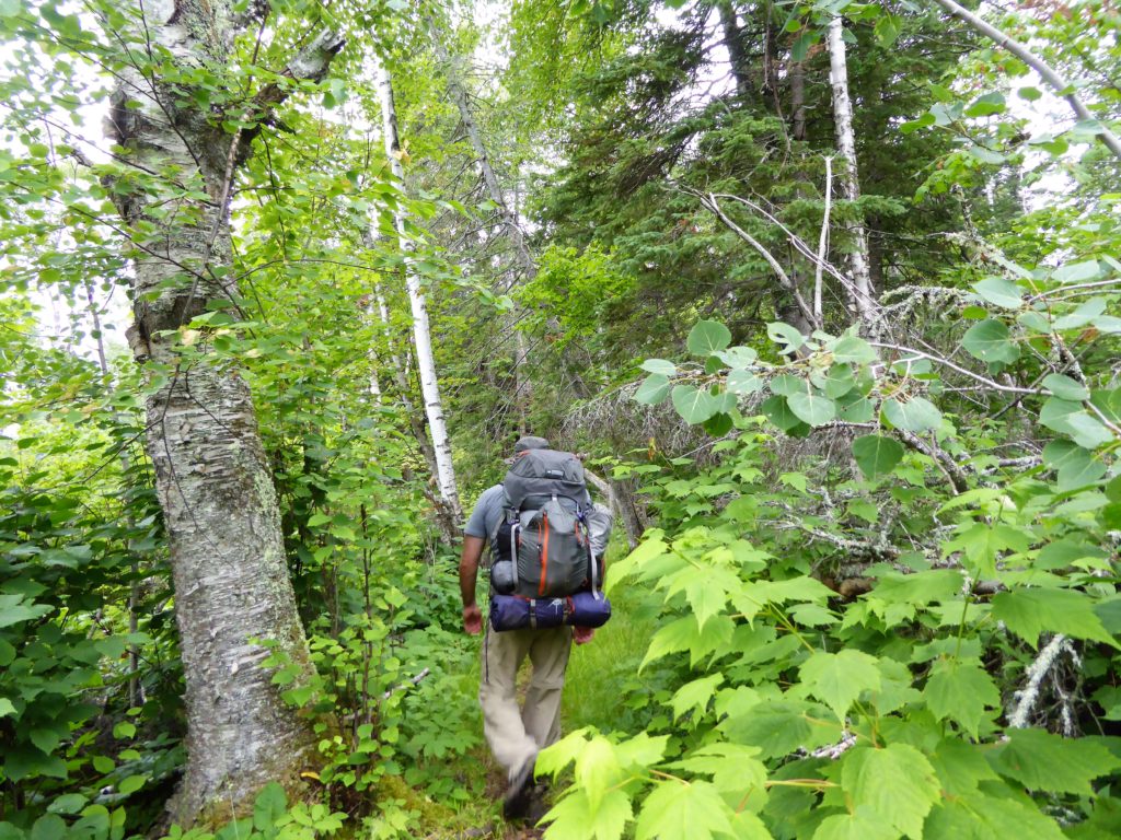
After a few photos, we doubled back to our packs and began walking south on the Superior Hiking Trail. The wider and busier trails of Magney State Park soon gave way to the narrower walking track of the SHT.
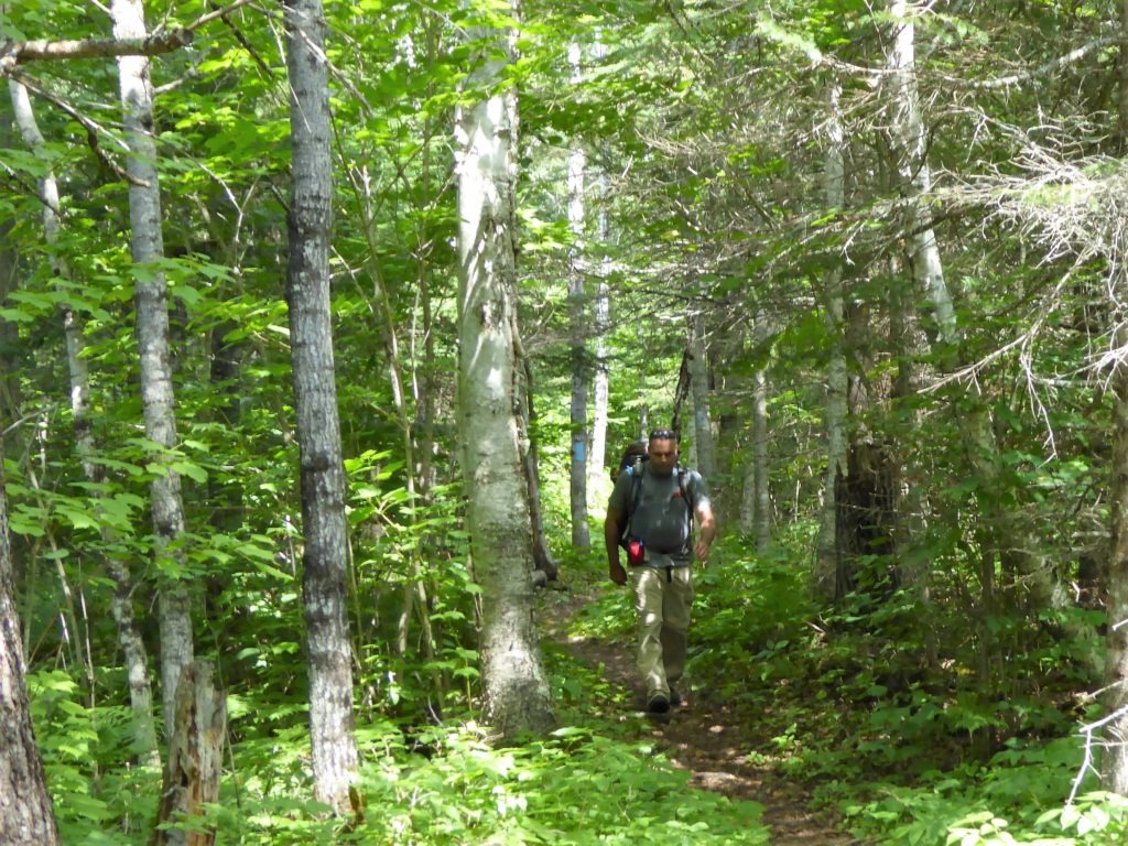
This section of the SHT runs the serrated edges of Minnesota’s Sawtooth Mountains. Our first few hours crossed woods, creeks, and occasional boardwalks over soggy stretches of forest. By midday, we descended to one of the SHT’s highlights–the “Lake Walk.”
The Lake Walk is 1.5 to 2 mile stretch of cobblestone beach along the Superior shoreline. Many hikers skip the cobbles since they make for slow going and sore ankles. (You can bypass the beach by walking two miles of Highway 61 shoulder.) But this is a pretty stretch of water with volcanic islands and nice spots for lunch and an ice-cold jump in the lake. For us, it just seemed wrong skip the only stretch of the Superior Hiking Trail that’s actually on Lake Superior?!
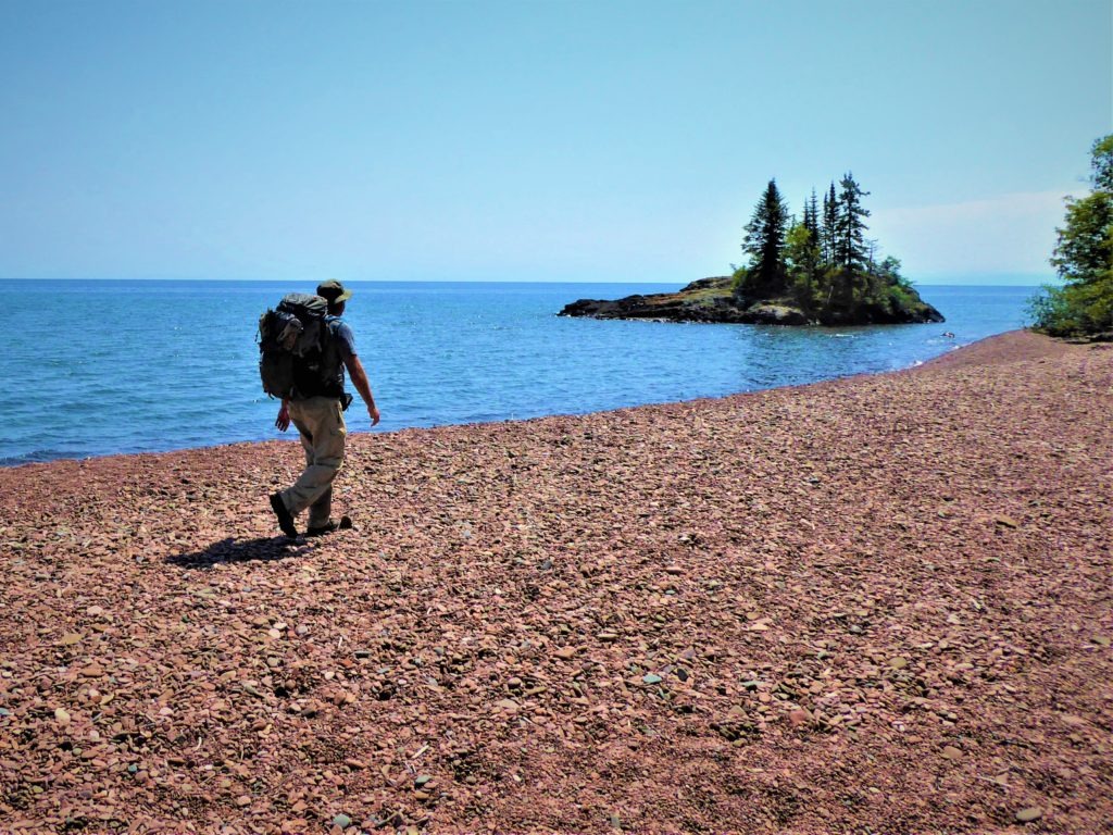
This was our last good view of the big lake. We assumed we’d see more of Lake Superior from the Superior Hiking Trail. After the Lake Walk and Wildflower Hill (on day two), however, we did not see the water. The trail ran a few miles inland, and fog and rain blocked the Lake Superior overlook from Pincushion Mountain.
As their name suggests, the Sawtooths offer plenty of up and downs, elevation-wise. If you’ve hiked outside the Midwest, however, the low ridges of the Sawtooths may seem more like “hills” and “valleys” than “mountains” and “canyons.” For us, this was easy to moderate hiking. We averaged 2 mph with full packs. There was no scrambling or peaks to climb–just undulating hills, frequent mazes of tree roots, and short slogs up the bluffs of some rivers and creeks.
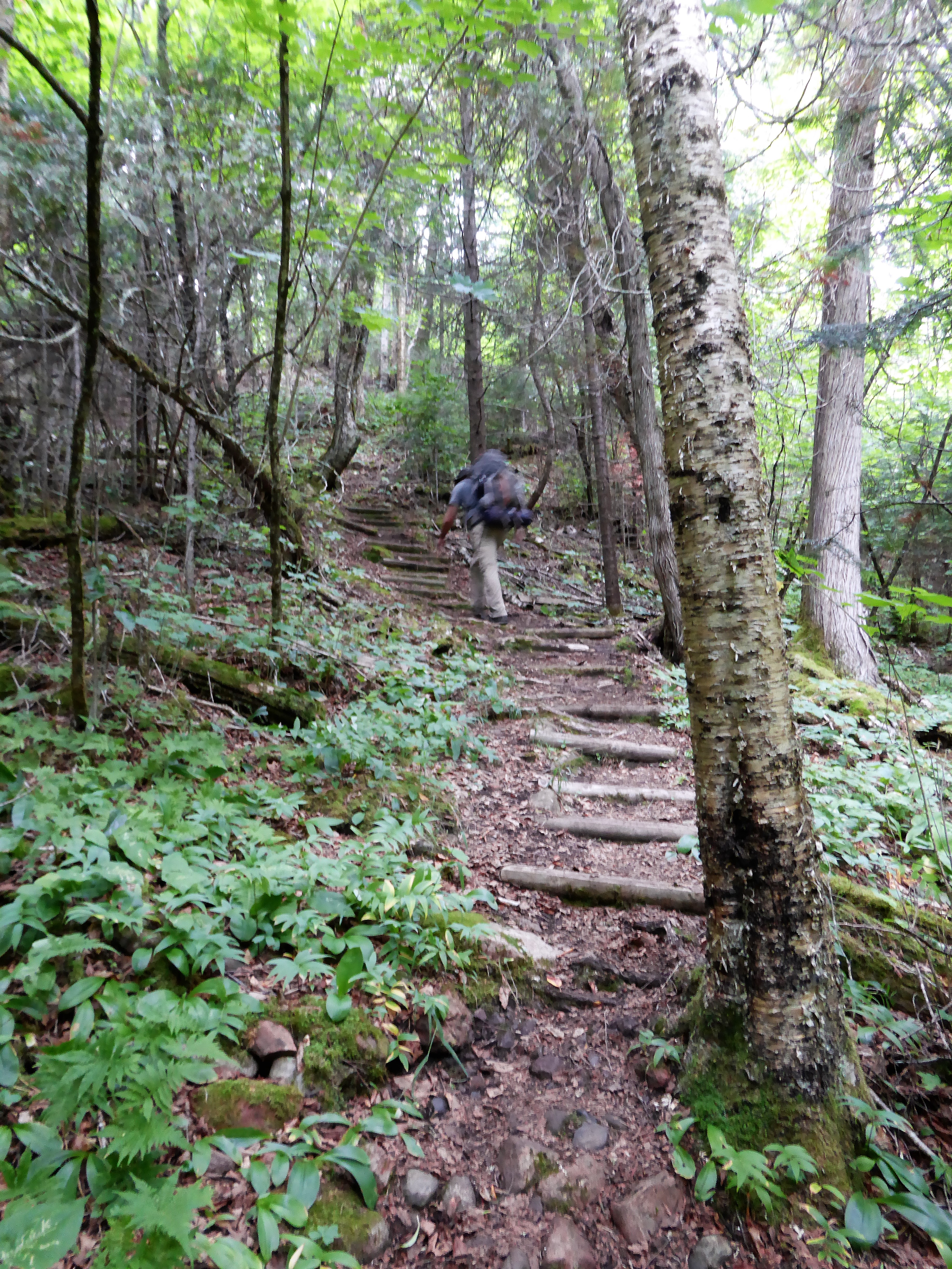
Still, this was a solid hike by Midwestern standards. We mostly had the trail to ourselves. We only met backpackers once or twice a day on the back country stretches of the SHT. And the trail packed in Northwoods pleasures. We filtered water from root beer-colored rivers and walked along streams of slick rock, boulders, and small waterfalls.

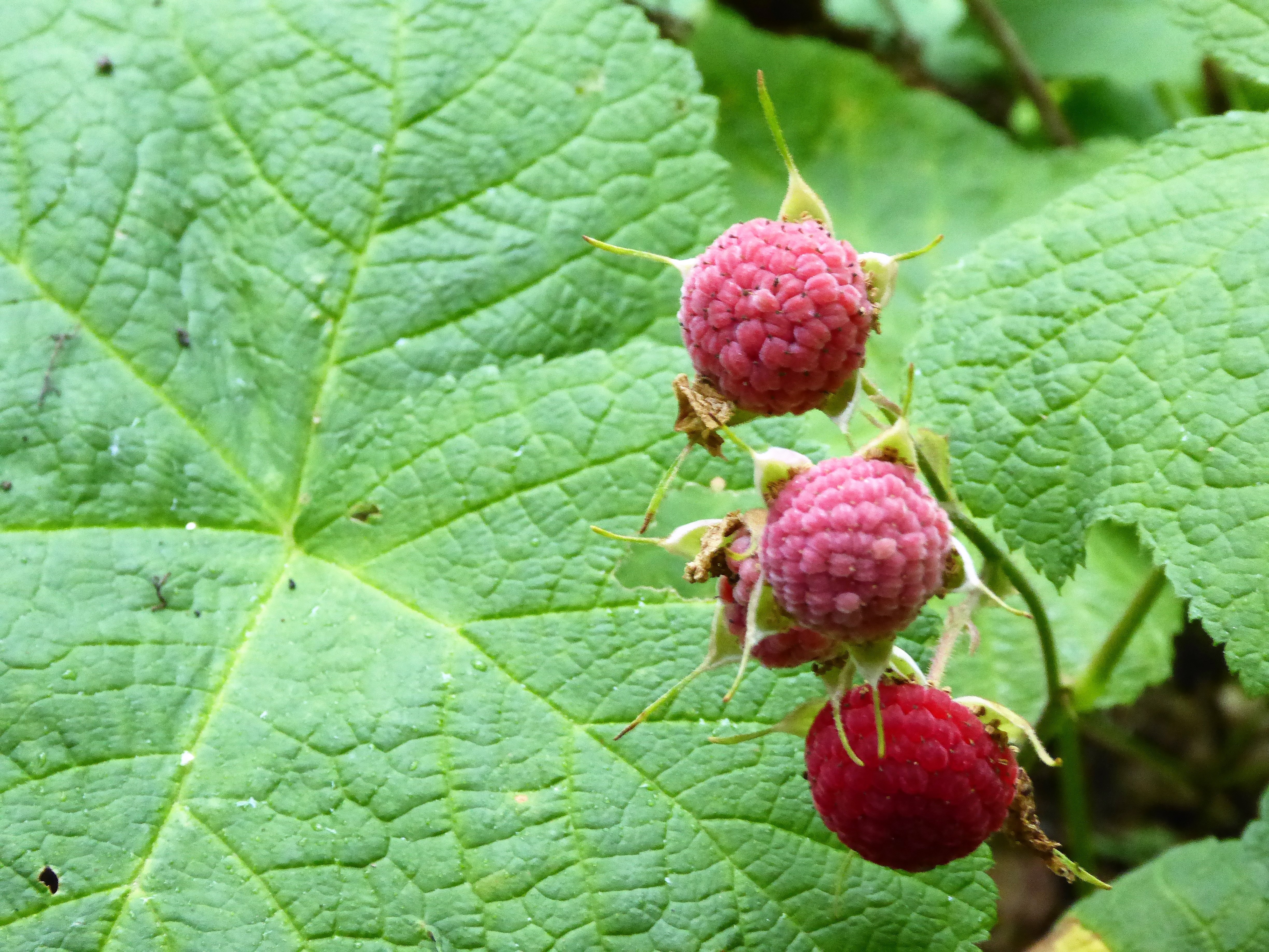
We plucked tart thimbleberries and grazed on wild raspberries and elusive blueberries, making sure to leave plenty for the bears and other backpackers. And we tried to appreciate the subtle changes in the trees and fungi as the trail weaved its way in and out of river valleys and up and down the Sawtooth mountains.
The hiking and the scenery on our route generally got better the closer we got to Grand Marais. The creeks and rivers increased in size and number from the Kadunce River south. So did the trees and mushrooms. And Devil’s Track Canyon (not pictured due to steady rain and fog) was the highlight of the hike–the gorge offered some scenic views and more sustained climbs.
honest trail review
The Superior Hiking Association should feel proud of this trail. But we decided not to commit three weeks (or so) next summer to thru-hike the Superior Hiking Trail. We’re not sure if there’s enough variety or highlights to keep us backpacking through 255 miles of trees, bogs, mosquitoes, streams, and low mountains.
For us, the hike was missing those signature moments, like a panoramic peak or secret waterfall, that were off the beaten path. Quite the opposite, the best waterfalls and overlooks on this trek were easily accessible from the well-beaten paths of Minnesota state parks and Highway 61 waysides.
That’s the good news/bad news about this hike. The SHT is a great choice for beginning backpackers–it offers easy access to wilderness, solitude, and primitive camping with convenient bail-out points to reach Highway 61 in a hurry if you run into trouble. With this accessibility, however, backpackers rarely escape the noise of the highway. And they don’t get the best views by leaving the highway, either. Unlike most backpacks, the best scenery is generally close to the road–not in the back country.
slackpacking the SHT
We could also make a good case for “slackpacking” the SHT, especially since the back country on this route doesn’t provide backpackers with better scenery or wildlife viewing than day hikers can access through Minnesota’s excellent network of state parks and waysides off Highway 61. With easy to moderate elevation gains, strong hikers and trail runners could cover a lot of distance on the SHT by swapping their backpacks for day packs and arranging transportation through the Superior Hiking Shuttle or Harriet Quarles’ taxi and shuttle service. Slackpackers can also arrange lodge to lodge hiking packages with participating lodges and B&B’s between Two Harbors and Grand Marais.
recommendations
We just sampled a small taste of the Superior Hiking Trail that we found recommended in newspapers and travel forums. The Superior Hiking Trail Association will share their local expertise, but we have a few newbie recommendations to make the most of this accessible trail:
- Splurge on some North Shore delicacies. We supplemented our typical backpackers’ fare with a day one lunch of smoked salmon salad from Duluth’s Northern Waters Smokehaus and a day two breakfast of the World’s Best Donuts from Grand Marais.
- Know your berries! We ate raspberries and thimbleberries and found one stand of small blueberries, but we could have sampled 9 or 10 wild berries had we done more research. Next time, we’ll do some advance study, talk with rangers, and consider buying a field guide to identify edible (and inedible) berries in Minnesota.
- Big Critters. We didn’t see or hear much wildlife on our hike, but this is bear country. Pack a bear canister or bear bag if you’ve got one–or at least hang your food, trash, and personal hygiene products in a tree at least 200 feet from your tent. (See online for recommendations–the trees weren’t ideal for this near our campsites.)
- Little Critters. Mosquitoes are a nuance up north, so don’t forget your bug spray. Ticks can be thick through portions of the SHT, but our section didn’t have many in late summer.
- Support the Superior Hiking Trail Association. Become a member or make a donation to support the volunteers who have created and maintained this trail. To tap their local expertise, stop by their information center in Two Harbors, MN (Mon, Thu, & Fri, 10-5) or visit their trail store to purchase maps or their official Guide to the Superior Hiking Trail.
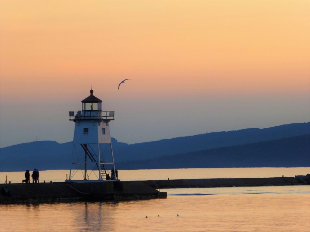
- If you’ve got time, stay an extra day or two along the North Shore. We enjoyed some downtime in Grand Marais after our hike. It’s a photogenic town with regional craft beers on tap and outdoor dining options that let you enjoy lake breezes and harbor sunsets: